Samalqan County
Persian: شهرستان سملقان | |
|---|---|
County | |
.svg.png.webp) Location of Samalqan County in North Khorasan province | |
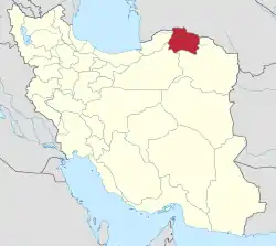 Location of North Khorasan province in Iran | |
| Coordinates: 37°43′N 56°39′E / 37.717°N 56.650°E[1] | |
| Country | |
| Province | North Khorasan |
| Capital | Ashkhaneh |
| Districts | Central, Samalqan |
| Population (2016)[2] | |
| • Total | 101,727 |
| Time zone | UTC+3:30 (IRST) |
Samalqan County (Persian: شهرستان سملقان), formerly Maneh and Samalqan County, or Mana and Samangan (شهرستان مانه و سملقان تایباد),[3] Maneh va Samalqan, is in North Khorasan province, Iran. Its capital is the city of Ashkhaneh.[4]
At the 2006 census, the county's population was 91,884 in 23,040 households.[5] The following census in 2011 counted 103,944 people in 28,261 households.[6] At the 2016 census, the county's population was 101,727 in 29,624 households.[2]
Administrative divisions
The population history and structural changes of Samalqan County's administrative divisions over three consecutive censuses are shown in the following table. The latest census shows three districts, six rural districts, and four cities.[2]
In 2023, Maneh District was separated from the county in the establishment of Maneh County, which was divided into two districts of two rural districts each, with the city of Pish Qaleh as its capital.[3]
| Administrative Divisions | 2006[5] | 2011[6] | 2016[2] |
|---|---|---|---|
| Central District | 44,804 | 53,563 | 53,110 |
| Howmeh RD | 15,676 | 16,718 | 14,725 |
| Jeyransu RD | 10,894 | 13,968 | 13,281 |
| Ashkhaneh (city) | 18,234 | 22,877 | 25,104 |
| Maneh District1 | 26,459 | 26,461 | 26,082 |
| Atrak RD | 17,067 | 15,431 | 14,463 |
| Shirin Su RD | 7,761 | 8,819 | 9,618 |
| Pish Qaleh (city) | 1,631 | 2,211 | 2,001 |
| Samalqan District | 20,621 | 22,335 | 21,378 |
| Almeh RD | 7,517 | 7,866 | 7,788 |
| Qazi RD | 10,734 | 11,513 | 7,169 |
| Ava (city)2 | 3,993 | ||
| Qazi (city) | 2,370 | 2,956 | 2,428 |
| Total | 91,884 | 103,944 | 101,727 |
| RD: Rural District 1Became a part of Maneh County after the 2016 census[3] 2Merger of two villages[7] | |||
References
- ↑ OpenStreetMap contributors (19 May 2023). "Maneh and Samalqan County" (Map). OpenStreetMap. Retrieved 19 May 2023.
- 1 2 3 4 "Census of the Islamic Republic of Iran, 1395 (2016)". AMAR (in Persian). The Statistical Center of Iran. p. 28. Archived from the original (Excel) on 27 October 2020. Retrieved 19 December 2022.
- 1 2 3 Mokhbar, Mohammad (7 August 2023). "Approval letter regarding country divisions in North Khorasan and Golestan provinces". RRK (in Persian). Ministry of Interior, Board of Ministers. Archived from the original on 9 August 2023. Retrieved 27 October 2023.
- ↑ Habibi, Hassan (17 December 1379). "Creating changes and reforms in the country divisions of Bojnord County in Khorasan province". Islamic Parliament Research Center (in Persian). Ministry of Interior, Board of Ministers. Archived from the original on 30 July 2010. Retrieved 11 January 2024.
- 1 2 "Census of the Islamic Republic of Iran, 1385 (2006)". AMAR (in Persian). The Statistical Center of Iran. p. 28. Archived from the original (Excel) on 20 September 2011. Retrieved 25 September 2022.
- 1 2 "Census of the Islamic Republic of Iran, 1390 (2011)". Syracuse University (in Persian). The Statistical Center of Iran. p. 28. Archived from the original (Excel) on 19 January 2023. Retrieved 19 December 2022.
- ↑ Rahimi, Mohammad Reza (5 July 2013). "Six new cities and towns were added to the map of country divisions". DOLAT (in Persian). Ministry of Interior, Board of Ministers. Archived from the original on 14 July 2014. Retrieved 19 May 2023.
North Khorasan Province, Iran | |||||||||||||||
|---|---|---|---|---|---|---|---|---|---|---|---|---|---|---|---|
| Capital |  | ||||||||||||||
| Counties and cities |
| ||||||||||||||
| Sights |
| ||||||||||||||
| populated places | |||||||||||||||