Simkot
सिमकोट गाउँपालिका | |
|---|---|
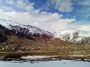 Simkot village | |
 Simkot Location in Nepal | |
| Coordinates: 29°58′18″N 81°49′15″E / 29.97167°N 81.82083°E | |
| Country | |
| Province | Karnali Province |
| District | Humla |
| Wards | 8 |
| Established | 10 March 2017 |
| Government | |
| • Type | Rural Council |
| • Chairperson | Mr.Padam Bahadur Lama (NC) |
| • Vice-chairperson | Mr.Wali Rawat -Independent |
| Area | |
| • Total | 785.89 km2 (303.43 sq mi) |
| Population (2011) | |
| • Total | 11,557 |
| • Density | 15/km2 (38/sq mi) |
| Time zone | UTC+5:45 (NST) |
| Headquarter | Simikot |
| Website | simkotmun |
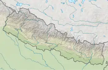
Simkot (Nepali: सिमकोट गाउँपालिका) is a rural municipality located in Humla District of Karnali Province of Nepal.[1][2][3]
The rural municipality is divided into total 8 wards and the headquarters of the rural municipality is situated at Simikot.
Simikot airport is one and only airport of Humla, located on Simikot. Simkot serves as the gateway to Mansarobar/ Kailash pilgrimage.
Demographics
At the time of the 2011 Nepal census, 80.0% of the population in Simkot Rural Municipality spoke Nepali, 18.7% Tamang, 0.3% Magar, 0.3% Sign language, 0.2% Maithili and 0.1% Doteli as their first language; 0.4% spoke other languages.
In terms of ethnicity/caste, 40.5% were Chhetri, 25.1% Thakuri, 19.1% Tamang, 9.9% Kami, 1.9% Damai/Dholi, 1.1% Hill Brahmin, 0.8% Byasi/Sauka, 0.5% Magar and 1.1% others.
In terms of religion, 80.2% were Hindu, 19.4% Buddhist, 0.2% Christian, 0.1% Muslim and 0.1% others.[4]
References
- ↑ "स्थानीय तहहरुको विवरण (Details of local levels)". www.mofald.gov.np/en. Ministry of Federal Affairs and General Administration. Retrieved 2 October 2018.
- ↑ "Final District 1-75 Corrected Last for RAJPATRA" (PDF). Retrieved 2 October 2018.
- ↑ "Simkot Rural Municipality in Nepal". CITY POPULATION. Retrieved 2 October 2018.
- ↑ NepalMap Demographics
External links
Headquarters: Simikot | ||
| Rural municipalities: | 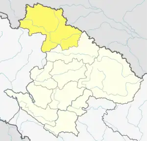 | |
List of municipalities and rural municipalities of Nepal | ||