| Tatton Wagga Wagga, New South Wales | |||||||||||||||
|---|---|---|---|---|---|---|---|---|---|---|---|---|---|---|---|
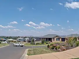
 Tamar Drive in Tatton | |||||||||||||||
 Tatton | |||||||||||||||
| Coordinates | 35°9′26″S 147°21′44″E / 35.15722°S 147.36222°E | ||||||||||||||
| Population | 2,616 (2006 census)[1] | ||||||||||||||
| Postcode(s) | 2650 | ||||||||||||||
| LGA(s) | City of Wagga Wagga | ||||||||||||||
| County | Wynyard | ||||||||||||||
| Parish | South Wagga Wagga | ||||||||||||||
| State electorate(s) | Wagga Wagga | ||||||||||||||
| Federal division(s) | Riverina | ||||||||||||||
| |||||||||||||||
Tatton is an outer south-eastern suburb of Wagga Wagga, New South Wales, Australia. To the south of Kooringal and to the west of Lake Albert, Tatton is one of Wagga Wagga's more expensive new suburbs. Subdivision of what was an area dominated by small rural holdings, commenced in the 1990s. Tatton Public School was previously located within the confines of the suburb, however this school closed down prior to the commencement of any significant development. Today the suburb is serviced by the private Lutheran Primary School.
References
- ↑ Australian Bureau of Statistics (25 October 2007). "Tatton (State Suburb)". 2006 Census QuickStats. Retrieved 27 June 2017.
External links
![]() Media related to Tatton, New South Wales at Wikimedia Commons
Media related to Tatton, New South Wales at Wikimedia Commons
This article is issued from Wikipedia. The text is licensed under Creative Commons - Attribution - Sharealike. Additional terms may apply for the media files.