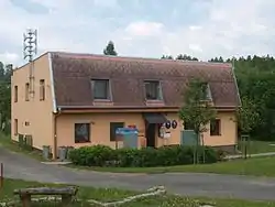
Václavov u Bruntálu | |
|---|---|
 Municipal office | |
 Flag  Coat of arms | |
 Václavov u Bruntálu Location in the Czech Republic | |
| Coordinates: 49°58′29″N 17°22′35″E / 49.97472°N 17.37639°E | |
| Country | |
| Region | Moravian-Silesian |
| District | Bruntál |
| First mentioned | 1405 |
| Area | |
| • Total | 25.78 km2 (9.95 sq mi) |
| Elevation | 585 m (1,919 ft) |
| Population (2023-01-01)[1] | |
| • Total | 520 |
| • Density | 20/km2 (52/sq mi) |
| Time zone | UTC+1 (CET) |
| • Summer (DST) | UTC+2 (CEST) |
| Postal code | 792 01 |
| Website | www |
Václavov u Bruntálu (German: Wildgrub) is a municipality in Bruntál District in the Moravian-Silesian Region of the Czech Republic. It has about 500 inhabitants.
Administrative parts
The municipality is made up of villages of Dolní Václavov and Horní Václavov.
History
According to the Austrian census of 1910 the village had 1,145 inhabitants, all of them were German-speaking. Most populous religious group were Roman Catholics with 99.1%.[2]
References
- ↑ "Population of Municipalities – 1 January 2023". Czech Statistical Office. 2023-05-23.
- ↑ Ludwig Patryn (ed): Die Ergebnisse der Volkszählung vom 31. Dezember 1910 in Schlesien, Troppau 1912.
External links
Wikimedia Commons has media related to Václavov u Bruntálu.
This article is issued from Wikipedia. The text is licensed under Creative Commons - Attribution - Sharealike. Additional terms may apply for the media files.