Výčapy | |
|---|---|
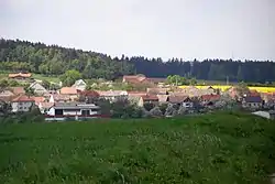 General view | |
 Flag  Coat of arms | |
 Výčapy Location in the Czech Republic | |
| Coordinates: 49°8′37″N 15°52′39″E / 49.14361°N 15.87750°E | |
| Country | |
| Region | Vysočina |
| District | Třebíč |
| First mentioned | 1104 |
| Area | |
| • Total | 13.36 km2 (5.16 sq mi) |
| Elevation | 478 m (1,568 ft) |
| Population (2023-01-01)[1] | |
| • Total | 867 |
| • Density | 65/km2 (170/sq mi) |
| Time zone | UTC+1 (CET) |
| • Summer (DST) | UTC+2 (CEST) |
| Postal code | 674 01 |
| Website | www |
Výčapy is a municipality and village in Třebíč District in the Vysočina Region of the Czech Republic. It has about 900 inhabitants.
Výčapy lies approximately 9 kilometres (6 mi) south of Třebíč, 35 km (22 mi) south-east of Jihlava, and 149 km (93 mi) south-east of Prague.
Administrative parts
The village of Štěpánovice is an administrative part of Výčapy.
References
Wikimedia Commons has media related to Výčapy.
This article is issued from Wikipedia. The text is licensed under Creative Commons - Attribution - Sharealike. Additional terms may apply for the media files.