Vyskytná | |
|---|---|
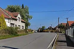 Main road | |
 Flag  Coat of arms | |
 Vyskytná Location in the Czech Republic | |
| Coordinates: 49°25′42″N 15°21′56″E / 49.42833°N 15.36556°E | |
| Country | |
| Region | Vysočina |
| District | Pelhřimov |
| First mentioned | 1352 |
| Area | |
| • Total | 14.69 km2 (5.67 sq mi) |
| Elevation | 613 m (2,011 ft) |
| Population (2023-01-01)[1] | |
| • Total | 728 |
| • Density | 50/km2 (130/sq mi) |
| Time zone | UTC+1 (CET) |
| • Summer (DST) | UTC+2 (CEST) |
| Postal codes | 393 01, 394 05 |
| Website | www |
Vyskytná (German: Böhmisch Gießhübel) is a municipality and village in Pelhřimov District in the Vysočina Region of the Czech Republic. It has about 700 inhabitants.
Vyskytná lies approximately 11 kilometres (7 mi) east of Pelhřimov, 17 km (11 mi) west of Jihlava, and 100 km (62 mi) south-east of Prague.
Administrative parts
Villages of Branišov and Sedliště are administrative parts of Vyskytná.
History
The first written mention of Vyskytná is from 1352. The village was originally a town, which was devastated during the Hussite Wars.[2]
Sights
The Church of the Name of the Virgin Mary was built in the Gothic style in 1290.[2]
References
- ↑ "Population of Municipalities – 1 January 2023". Czech Statistical Office. 2023-05-23.
- 1 2 "Historie obce" (in Czech). Obec Vyskytná. Retrieved 2021-10-22.
Wikimedia Commons has media related to Vyskytná.
This article is issued from Wikipedia. The text is licensed under Creative Commons - Attribution - Sharealike. Additional terms may apply for the media files.