Xingnan Subdistrict
兴南街道 | |
|---|---|
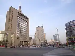
 Nanmenwai Avenue on the eastern side of the subdistrict, 2006 | |
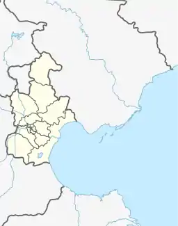
.png.webp) Location of Xingnan Subdistrict in Nankai District | |
 Xingnan Subdistrict  Xingnan Subdistrict | |
| Coordinates: 39°07′31″N 117°10′12″E / 39.12528°N 117.17000°E | |
| Country | China |
| Municipality | Tianjin |
| District | Nankai |
| Village-level Divisions | 9 communities |
| Area | |
| • Total | 1.45 km2 (0.56 sq mi) |
| Elevation | 7 m (23 ft) |
| Population (2010) | |
| • Total | 43,744 |
| • Density | 30,000/km2 (78,000/sq mi) |
| Time zone | UTC+8 (China Standard) |
| Postal code | 300100 |
| Area code | 022 |
Xingnan Subdistrict (simplified Chinese: 兴南街道; traditional Chinese: 興南街道; pinyin: Xìngnán Jiēdào) is a subdistrict situated on the northeast of Nankai District, Tianjin, China. It borders Gulou Subdistrict to its north, Nanshi and Quanyechang Subdistricts to its east. Wanxing Subdistrict to its south, Guangkai Subdistrict to its west. In the year 2010, the subdistrict had 43,744 inhabitants under its administration.[1]
The subdistrict was created from Paotaizhuang and Nanmenxi Subdistricts in 1999. Its name Xingnan (Chinese: 兴南; lit. 'Prosper South') was given with the intended meaning of "Make Nankai District Prosperous".[2]
Administrative divisions
As of the year 2021, Xingnan Subdistrict consisted of the following 9 residential communities:[3]
| Subdivision Names | Name Transliterations |
|---|---|
| 南马路 | Nanmalu |
| 龙凤里 | Longfengli |
| 耀远里 | Yaoyuanli |
| 紫光苑 | Ziguangyuan |
| 昆裕里 | Kunyuli |
| 怀庆里 | Huaiqingli |
| 延生里 | Yanshengli |
| 源德里 | Yuandeli |
| 五马路 | Wumalu |
Gallery
.jpg.webp) Nanmenwai Avenue, 2006
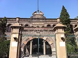
Nanmenwai Avenue, 2006 Former site of Nankai School, 2011
 Former Residence of Yang Yide, 2011
 Wumalu Community, 2014
References
- ↑ "China: Tiānjīn Municipal Province (Districts and Townships) - Population Statistics, Charts and Map". www.citypopulation.de. Retrieved 2022-11-05.
- ↑ 中华人民共和国政区大典:天津市卷 (in Chinese). 中国社会出版社. 2020.
- ↑ "2021年统计用区划代码和城乡划分代码". www.stats.gov.cn. Retrieved 2022-11-20.
This article is issued from Wikipedia. The text is licensed under Creative Commons - Attribution - Sharealike. Additional terms may apply for the media files.