Yio Chu Kang | |
|---|---|
Subzone of Ang Mo Kio Planning Area | |
| Name transcription(s) | |
| • Chinese | 杨厝港 (Simplified) 楊厝港 (Traditional) Yángcuògǎng (Pinyin) Iôⁿ-chhù-káng (Hokkien POJ) |
| • Malay | Yio Chu Kang |
| • Tamil | இயோ சூ காங் Iyō cū kāṅ (Transliteration) |
 | |
| Coordinates: 01°22′52″N 103°50′39″E / 1.38111°N 103.84417°E | |
| Country | Singapore |
Yio Chu Kang (/ˌjoʊ tʃuː ˈkʌŋ/ YOH choo KUNG), alternatively spelt as Yeo Chu Kang, is a sub-urban area in the northeast of Singapore, with proximity to the Ang Mo Kio, Lentor, Seletar and Sengkang areas. Deriving its name from the Yio Chu Kang Village, it is still known for lush greenery and low-density housing with high-rise public housing in its southern fringes.
Background
The name Yio Chu Kang, similar to Choa Chu Kang and Lim Chu Kang did not come from names of famous people unlike many other road names in Singapore. The word 'Kang' - means river, while 'Chu' was apparently a clan. The word 'Chu' itself means "owner" or "land". The clan was hence named Kangchu because it was controlled by the Chu clan and they were situated around a river. The north of Singapore was split and given to different leaders of the Kangchu clan, and they took the name of the leader. Hence the names Yio Chu Kang, Lim Chu Kang and Choa Chu Kang.[1]
Educational institutions
Primary schools
- Anderson Primary School
Secondary schools
Tertiary Institutions
Other amenities
- Yio Chu Kang Stadium
- Chu Sheng Temple
- Swee Kow Kuan Temple
Transportation
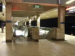
Situated at the northern portion of Ang Mo Kio, Yio Chu Kang is served by bus services originating from Yio Chu Kang Bus Interchange, Ang Mo Kio Bus Depot, Ang Mo Kio Bus Interchange and Yishun (85x services). Yio Chu Kang MRT station also serves the area, providing residents a direct link to the relatively distant Central Area.
References
- ↑ "The real meaning of the "Chu" in Choa Chu Kang, Yio Chu Kang and Lim Chu Kang". Goody Feed. 2015-09-15. Retrieved 2018-09-20.