Abda | |
|---|---|
 Flag  Coat of arms | |
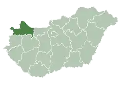
 Abda Location of Abda, Hungary | |
| Coordinates: 47°41′42″N 17°32′31″E / 47.69511°N 17.54194°E | |
| Country | |
| County | Győr-Moson-Sopron |
| Government | |
| • Mayor | Zsolt Szabó |
| Area | |
| • Total | 19.02 km2 (7.34 sq mi) |
| Population (2008) | |
| • Total | 3,126 |
| • Density | 164.19/km2 (425.3/sq mi) |
| Time zone | UTC+1 (CET) |
| • Summer (DST) | UTC+2 (CEST) |
| Postal code | 9151 |
| Area code | 96 |
| Motorways | M1, M85 |
| Distance from Budapest | 134 km (83 mi) East |
Abda is a village in Győr-Moson-Sopron county, Hungary.

Aerial photography on the St. Joseph's Church of Abda
Etymology
The name comes from Slavic languages *ob(v)oda — literally "a place around which water flows". See i.e. similar Slavic names Obod, Obodnik, Obodnica (Serbo-Croatian language area) or Obodno (Poland).[1]
References
- ↑ Stanislav, Ján (2004). Slovenský juh v stredoveku II (in Slovak). Slovenské literárne centrum. pp. 7, 520. ISBN 80-88878-89-6.
External links
- Street map (in Hungarian)
- Aerial photographs of Abda

This article is issued from Wikipedia. The text is licensed under Creative Commons - Attribution - Sharealike. Additional terms may apply for the media files.