Aibre | |
|---|---|
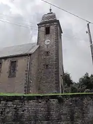 The temple in Aibre | |
 Coat of arms | |
Location of Aibre | |
 Aibre 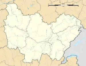 Aibre | |
| Coordinates: 47°33′07″N 6°41′51″E / 47.5519°N 6.6975°E | |
| Country | France |
| Region | Bourgogne-Franche-Comté |
| Department | Doubs |
| Arrondissement | Montbéliard |
| Canton | Bavans |
| Intercommunality | Pays d'Héricourt |
| Government | |
| • Mayor (2020–2026) | Pascal Boulade[1] |
| Area 1 | 4.5 km2 (1.7 sq mi) |
| Population | 464 |
| • Density | 100/km2 (270/sq mi) |
| Time zone | UTC+01:00 (CET) |
| • Summer (DST) | UTC+02:00 (CEST) |
| INSEE/Postal code | 25008 /25750 |
| Elevation | 348–473 m (1,142–1,552 ft) |
| 1 French Land Register data, which excludes lakes, ponds, glaciers > 1 km2 (0.386 sq mi or 247 acres) and river estuaries. | |
Aibre (French pronunciation: [ɛbʁ]) is a commune in the Doubs department in the Bourgogne-Franche-Comté region in eastern France.
Population
| Year | Pop. | ±% p.a. |
|---|---|---|
| 1968 | 221 | — |
| 1975 | 258 | +2.24% |
| 1982 | 522 | +10.59% |
| 1990 | 504 | −0.44% |
| 1999 | 455 | −1.13% |
| 2007 | 456 | +0.03% |
| 2012 | 466 | +0.43% |
| 2017 | 473 | +0.30% |
| Source: INSEE[3] | ||
See also
References
- ↑ "Répertoire national des élus: les maires" (in French). data.gouv.fr, Plateforme ouverte des données publiques françaises. 13 September 2022.
- ↑ "Populations légales 2021". The National Institute of Statistics and Economic Studies. 28 December 2023.
- ↑ Population en historique depuis 1968, INSEE
Wikimedia Commons has media related to Aibre.
This article is issued from Wikipedia. The text is licensed under Creative Commons - Attribution - Sharealike. Additional terms may apply for the media files.