Hauterive-la-Fresse | |
|---|---|
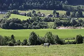 A general view of Hauterive-la-Fresse | |
Location of Hauterive-la-Fresse | |
 Hauterive-la-Fresse 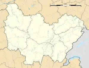 Hauterive-la-Fresse | |
| Coordinates: 46°58′12″N 6°26′59″E / 46.97°N 6.4497°E | |
| Country | France |
| Region | Bourgogne-Franche-Comté |
| Department | Doubs |
| Arrondissement | Pontarlier |
| Canton | Ornans |
| Intercommunality | Montbenoît |
| Government | |
| • Mayor (2020–2026) | Emma Jacquet Pierroulet[1] |
| Area 1 | 7.46 km2 (2.88 sq mi) |
| Population | 225 |
| • Density | 30/km2 (78/sq mi) |
| Time zone | UTC+01:00 (CET) |
| • Summer (DST) | UTC+02:00 (CEST) |
| INSEE/Postal code | 25303 /25650 |
| Elevation | 778–1,210 m (2,552–3,970 ft) |
| 1 French Land Register data, which excludes lakes, ponds, glaciers > 1 km2 (0.386 sq mi or 247 acres) and river estuaries. | |
Hauterive-la-Fresse (French pronunciation: [otʁiv la fʁɛs]) is a commune in the Doubs department in the Bourgogne-Franche-Comté region in eastern France.
Population
| Year | Pop. | ±% |
|---|---|---|
| 1962 | 120 | — |
| 1968 | 124 | +3.3% |
| 1975 | 92 | −25.8% |
| 1982 | 89 | −3.3% |
| 1990 | 103 | +15.7% |
| 1999 | 145 | +40.8% |
| 2008 | 213 | +46.9% |
| 2012 | 210 | −1.4% |
See also
References
- ↑ "Répertoire national des élus: les maires". data.gouv.fr, Plateforme ouverte des données publiques françaises (in French). 9 August 2021.
- ↑ "Populations légales 2021". The National Institute of Statistics and Economic Studies. 28 December 2023.
Wikimedia Commons has media related to Hauterive-la-Fresse.
This article is issued from Wikipedia. The text is licensed under Creative Commons - Attribution - Sharealike. Additional terms may apply for the media files.