Sainte-Marie | |
|---|---|
 The town hall in Sainte-Marie | |
 Coat of arms | |
Location of Sainte-Marie | |
 Sainte-Marie 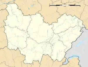 Sainte-Marie | |
| Coordinates: 47°30′29″N 6°41′46″E / 47.5081°N 6.6961°E | |
| Country | France |
| Region | Bourgogne-Franche-Comté |
| Department | Doubs |
| Arrondissement | Montbéliard |
| Canton | Bavans |
| Intercommunality | Pays de Montbéliard Agglomération |
| Government | |
| • Mayor (2020–2026) | Gérald Grosclaude[1] |
| Area 1 | 7.17 km2 (2.77 sq mi) |
| Population | 663 |
| • Density | 92/km2 (240/sq mi) |
| Time zone | UTC+01:00 (CET) |
| • Summer (DST) | UTC+02:00 (CEST) |
| INSEE/Postal code | 25523 /25113 |
| Elevation | 327–449 m (1,073–1,473 ft) |
| 1 French Land Register data, which excludes lakes, ponds, glaciers > 1 km2 (0.386 sq mi or 247 acres) and river estuaries. | |
Sainte-Marie (French pronunciation: [sɛ̃t maʁi] ⓘ) is a commune in the Doubs department in the Bourgogne-Franche-Comté region in eastern France.
Geography
The commune lies 10 km (6.2 mi) northwest of Montbéliard.
Population
| Year | Pop. | ±% |
|---|---|---|
| 1962 | 313 | — |
| 1968 | 446 | +42.5% |
| 1975 | 551 | +23.5% |
| 1982 | 646 | +17.2% |
| 1990 | 678 | +5.0% |
| 1999 | 698 | +2.9% |
| 2008 | 717 | +2.7% |
| 2012 | 736 | +2.6% |
See also
References
- ↑ "Répertoire national des élus: les maires" (in French). data.gouv.fr, Plateforme ouverte des données publiques françaises. 13 September 2022.
- ↑ "Populations légales 2021". The National Institute of Statistics and Economic Studies. 28 December 2023.
External links
Wikimedia Commons has media related to Sainte-Marie (Doubs).
- Sainte-Marie on the regional Web site (in French)
This article is issued from Wikipedia. The text is licensed under Creative Commons - Attribution - Sharealike. Additional terms may apply for the media files.