Champs-Romain | |
|---|---|
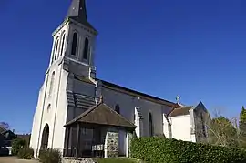 The church in Champs-Romain | |
Location of Champs-Romain | |
 Champs-Romain  Champs-Romain | |
| Coordinates: 45°31′55″N 0°46′34″E / 45.5319°N 0.7761°E | |
| Country | France |
| Region | Nouvelle-Aquitaine |
| Department | Dordogne |
| Arrondissement | Nontron |
| Canton | Périgord Vert Nontronnais |
| Government | |
| • Mayor (2020–2026) | Serge Viroulet[1] |
| Area 1 | 20.33 km2 (7.85 sq mi) |
| Population | 283 |
| • Density | 14/km2 (36/sq mi) |
| Time zone | UTC+01:00 (CET) |
| • Summer (DST) | UTC+02:00 (CEST) |
| INSEE/Postal code | 24101 /24470 |
| Elevation | 155–344 m (509–1,129 ft) (avg. 304 m or 997 ft) |
| 1 French Land Register data, which excludes lakes, ponds, glaciers > 1 km2 (0.386 sq mi or 247 acres) and river estuaries. | |
Champs-Romain (French pronunciation: [ʃɑ̃ ʁɔmɛ̃]; Occitan: Los Champs e Romenh) is a commune in the Dordogne department in Nouvelle-Aquitaine in southwestern France.
Population
| Year | Pop. | ±% |
|---|---|---|
| 1962 | 433 | — |
| 1968 | 410 | −5.3% |
| 1975 | 373 | −9.0% |
| 1982 | 332 | −11.0% |
| 1990 | 331 | −0.3% |
| 1999 | 328 | −0.9% |
| 2008 | 313 | −4.6% |
See also
References
- ↑ "Répertoire national des élus: les maires" (in French). data.gouv.fr, Plateforme ouverte des données publiques françaises. 13 September 2022.
- ↑ "Populations légales 2021". The National Institute of Statistics and Economic Studies. 28 December 2023.
Wikimedia Commons has media related to Champs-Romain.
This article is issued from Wikipedia. The text is licensed under Creative Commons - Attribution - Sharealike. Additional terms may apply for the media files.