Saint-Marcel-du-Périgord | |
|---|---|
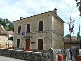 The town hall in Saint-Marcel-du-Périgord | |
.svg.png.webp) Coat of arms | |
Location of Saint-Marcel-du-Périgord | |
 Saint-Marcel-du-Périgord  Saint-Marcel-du-Périgord | |
| Coordinates: 44°54′59″N 0°42′47″E / 44.9164°N 0.7131°E | |
| Country | France |
| Region | Nouvelle-Aquitaine |
| Department | Dordogne |
| Arrondissement | Bergerac |
| Canton | Lalinde |
| Government | |
| • Mayor (2020–2026) | Yves Wrobel[1] |
| Area 1 | 11.46 km2 (4.42 sq mi) |
| Population | 141 |
| • Density | 12/km2 (32/sq mi) |
| Time zone | UTC+01:00 (CET) |
| • Summer (DST) | UTC+02:00 (CEST) |
| INSEE/Postal code | 24445 /24510 |
| Elevation | 81–195 m (266–640 ft) |
| 1 French Land Register data, which excludes lakes, ponds, glaciers > 1 km2 (0.386 sq mi or 247 acres) and river estuaries. | |
Saint-Marcel-du-Périgord (French pronunciation: [sɛ̃ maʁsɛl dy peʁiɡɔʁ], literally Saint-Marcel of the Périgord; Occitan: Sent Marcèl de Perigòrd) is a commune in the Dordogne department in Nouvelle-Aquitaine in southwestern France.
Population
| Year | Pop. | ±% p.a. |
|---|---|---|
| 1968 | 153 | — |
| 1975 | 134 | −1.88% |
| 1982 | 123 | −1.22% |
| 1990 | 140 | +1.63% |
| 1999 | 141 | +0.08% |
| 2009 | 148 | +0.49% |
| 2014 | 148 | +0.00% |
| 2020 | 144 | −0.46% |
| Source: INSEE[3] | ||
See also
References
- ↑ "Répertoire national des élus: les maires". data.gouv.fr, Plateforme ouverte des données publiques françaises (in French). 2 December 2020.
- ↑ "Populations légales 2021". The National Institute of Statistics and Economic Studies. 28 December 2023.
- ↑ Population en historique depuis 1968, INSEE
Wikimedia Commons has media related to Saint-Marcel-du-Périgord.
This article is issued from Wikipedia. The text is licensed under Creative Commons - Attribution - Sharealike. Additional terms may apply for the media files.