Saint-Geyrac | |
|---|---|
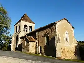 The church in Saint-Geyrac | |
Location of Saint-Geyrac | |
 Saint-Geyrac  Saint-Geyrac | |
| Coordinates: 45°05′20″N 0°54′55″E / 45.0889°N 0.9153°E | |
| Country | France |
| Region | Nouvelle-Aquitaine |
| Department | Dordogne |
| Arrondissement | Périgueux |
| Canton | Isle-Manoire |
| Intercommunality | Le Grand Périgueux |
| Government | |
| • Mayor (2020–2026) | Nils Fouchier[1] |
| Area 1 | 17.10 km2 (6.60 sq mi) |
| Population | 193 |
| • Density | 11/km2 (29/sq mi) |
| Time zone | UTC+01:00 (CET) |
| • Summer (DST) | UTC+02:00 (CEST) |
| INSEE/Postal code | 24421 /24330 |
| Elevation | 153–257 m (502–843 ft) (avg. 176 m or 577 ft) |
| 1 French Land Register data, which excludes lakes, ponds, glaciers > 1 km2 (0.386 sq mi or 247 acres) and river estuaries. | |
Saint-Geyrac (French pronunciation: [sɛ̃ ʒeʁak]; Occitan: Sengeirac) is a commune in the Dordogne department in Nouvelle-Aquitaine in southwestern France.
Population
| Year | Pop. | ±% |
|---|---|---|
| 1962 | 265 | — |
| 1968 | 253 | −4.5% |
| 1975 | 244 | −3.6% |
| 1982 | 235 | −3.7% |
| 1990 | 212 | −9.8% |
| 1999 | 199 | −6.1% |
| 2008 | 235 | +18.1% |
See also
References
- ↑ "Répertoire national des élus: les maires". data.gouv.fr, Plateforme ouverte des données publiques françaises (in French). 9 August 2021.
- ↑ "Populations légales 2021". The National Institute of Statistics and Economic Studies. 28 December 2023.
External links
Wikimedia Commons has media related to Saint-Geyrac.
This article is issued from Wikipedia. The text is licensed under Creative Commons - Attribution - Sharealike. Additional terms may apply for the media files.