Champs-sur-Tarentaine-Marchal | |
|---|---|
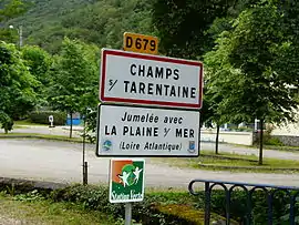 Road signs entering Champs-sur-Tarentaine-Marchal, on the D679 road | |
Location of Champs-sur-Tarentaine-Marchal | |
 Champs-sur-Tarentaine-Marchal  Champs-sur-Tarentaine-Marchal | |
| Coordinates: 45°23′48″N 2°33′42″E / 45.3967°N 2.5617°E | |
| Country | France |
| Region | Auvergne-Rhône-Alpes |
| Department | Cantal |
| Arrondissement | Mauriac |
| Canton | Ydes |
| Intercommunality | Sumène Artense |
| Government | |
| • Mayor (2020–2026) | Daniel Chevaleyre[1] |
| Area 1 | 60.32 km2 (23.29 sq mi) |
| Population | 1,022 |
| • Density | 17/km2 (44/sq mi) |
| Time zone | UTC+01:00 (CET) |
| • Summer (DST) | UTC+02:00 (CEST) |
| INSEE/Postal code | 15038 /15270 |
| Elevation | 449–966 m (1,473–3,169 ft) (avg. 450 m or 1,480 ft) |
| 1 French Land Register data, which excludes lakes, ponds, glaciers > 1 km2 (0.386 sq mi or 247 acres) and river estuaries. | |
Champs-sur-Tarentaine-Marchal (French pronunciation: [ʃɑ̃ syʁ taʁɑ̃tɛn maʁʃal]; Occitan: Champs e Marchalm) is a commune in the Cantal department in south-central France.
Geography
The river Rhue forms all of the commune's southern border.
Population
| Year | Pop. | ±% |
|---|---|---|
| 1962 | 1,452 | — |
| 1968 | 1,527 | +5.2% |
| 1975 | 1,331 | −12.8% |
| 1982 | 1,141 | −14.3% |
| 1990 | 1,088 | −4.6% |
| 1999 | 1,044 | −4.0% |
| 2008 | 1,033 | −1.1% |
See also
References
- ↑ "Répertoire national des élus: les maires". data.gouv.fr, Plateforme ouverte des données publiques françaises (in French). 2 December 2020.
- ↑ "Populations légales 2021". The National Institute of Statistics and Economic Studies. 28 December 2023.
Wikimedia Commons has media related to Champs-sur-Tarentaine-Marchal.
This article is issued from Wikipedia. The text is licensed under Creative Commons - Attribution - Sharealike. Additional terms may apply for the media files.