Saint-Cernin | |
|---|---|
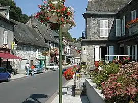 A view within the village of Saint-Cernin | |
Location of Saint-Cernin | |
 Saint-Cernin  Saint-Cernin | |
| Coordinates: 45°03′34″N 2°25′17″E / 45.0594°N 2.4214°E | |
| Country | France |
| Region | Auvergne-Rhône-Alpes |
| Department | Cantal |
| Arrondissement | Aurillac |
| Canton | Naucelles |
| Intercommunality | Pays de Salers |
| Government | |
| • Mayor (2020–2026) | André Dujols[1] |
| Area 1 | 46.75 km2 (18.05 sq mi) |
| Population | 1,055 |
| • Density | 23/km2 (58/sq mi) |
| Time zone | UTC+01:00 (CET) |
| • Summer (DST) | UTC+02:00 (CEST) |
| INSEE/Postal code | 15175 /15310 |
| Elevation | 556–985 m (1,824–3,232 ft) (avg. 760 m or 2,490 ft) |
| 1 French Land Register data, which excludes lakes, ponds, glaciers > 1 km2 (0.386 sq mi or 247 acres) and river estuaries. | |
Saint-Cernin (French pronunciation: [sɛ̃ sɛʁnɛ̃]; Occitan: Sant Sarnin) is a commune in the Cantal department in south-central France.
Population
| Year | Pop. | ±% |
|---|---|---|
| 1962 | 1,219 | — |
| 1968 | 1,448 | +18.8% |
| 1975 | 1,314 | −9.3% |
| 1982 | 1,245 | −5.3% |
| 1990 | 1,164 | −6.5% |
| 1999 | 1,128 | −3.1% |
| 2008 | 1,055 | −6.5% |
| 2016 | 1,073 | +1.7% |
See also
References
- ↑ "Répertoire national des élus: les maires". data.gouv.fr, Plateforme ouverte des données publiques françaises (in French). 9 August 2021.
- ↑ "Populations légales 2021". The National Institute of Statistics and Economic Studies. 28 December 2023.
Wikimedia Commons has media related to Saint-Cernin (Cantal).
This article is issued from Wikipedia. The text is licensed under Creative Commons - Attribution - Sharealike. Additional terms may apply for the media files.