Coulandon | |
|---|---|
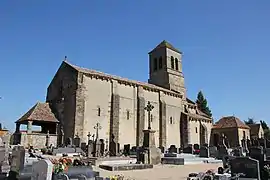 The church in Coulandon | |
Location of Coulandon | |
 Coulandon  Coulandon | |
| Coordinates: 46°33′05″N 3°15′24″E / 46.5514°N 3.2567°E | |
| Country | France |
| Region | Auvergne-Rhône-Alpes |
| Department | Allier |
| Arrondissement | Moulins |
| Canton | Moulins-1 |
| Intercommunality | CA Moulins Communauté |
| Government | |
| • Mayor (2020–2026) | Jean-Michel Griffet[1] |
| Area 1 | 17.06 km2 (6.59 sq mi) |
| Population | 637 |
| • Density | 37/km2 (97/sq mi) |
| Time zone | UTC+01:00 (CET) |
| • Summer (DST) | UTC+02:00 (CEST) |
| INSEE/Postal code | 03085 /03000 |
| Elevation | 212–278 m (696–912 ft) (avg. 226 m or 741 ft) |
| 1 French Land Register data, which excludes lakes, ponds, glaciers > 1 km2 (0.386 sq mi or 247 acres) and river estuaries. | |
Coulandon (French pronunciation: [kulɑ̃dɔ̃]) is a commune in the Allier department in central France.
Population
| Year | Pop. | ±% p.a. |
|---|---|---|
| 1968 | 466 | — |
| 1975 | 494 | +0.84% |
| 1982 | 493 | −0.03% |
| 1990 | 554 | +1.47% |
| 1999 | 594 | +0.78% |
| 2007 | 689 | +1.87% |
| 2012 | 687 | −0.06% |
| 2017 | 650 | −1.10% |
| Source: INSEE[3] | ||
See also
References
- ↑ "Répertoire national des élus: les maires" (in French). data.gouv.fr, Plateforme ouverte des données publiques françaises. 13 September 2022.
- ↑ "Populations légales 2021". The National Institute of Statistics and Economic Studies. 28 December 2023.
- ↑ Population en historique depuis 1968, INSEE
Wikimedia Commons has media related to Coulandon.
This article is issued from Wikipedia. The text is licensed under Creative Commons - Attribution - Sharealike. Additional terms may apply for the media files.