Saint-Angel | |
|---|---|
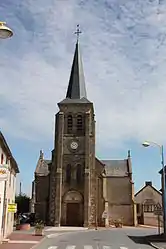 The church in Saint-Angel | |
Location of Saint-Angel | |
 Saint-Angel  Saint-Angel | |
| Coordinates: 46°21′30″N 2°41′54″E / 46.3583°N 2.6983°E | |
| Country | France |
| Region | Auvergne-Rhône-Alpes |
| Department | Allier |
| Arrondissement | Montluçon |
| Canton | Commentry |
| Intercommunality | Commentry Montmarault Néris Communauté |
| Government | |
| • Mayor (2020–2026) | Olivier Labouesse[1] |
| Area 1 | 25.27 km2 (9.76 sq mi) |
| Population | 759 |
| • Density | 30/km2 (78/sq mi) |
| Time zone | UTC+01:00 (CET) |
| • Summer (DST) | UTC+02:00 (CEST) |
| INSEE/Postal code | 03217 /03170 |
| Elevation | 242–406 m (794–1,332 ft) (avg. 360 m or 1,180 ft) |
| 1 French Land Register data, which excludes lakes, ponds, glaciers > 1 km2 (0.386 sq mi or 247 acres) and river estuaries. | |
Saint-Angel (French pronunciation: [sɛ̃.t‿ɑ̃ʒɛl]; Occitan: Sant Àngel) is a commune in the Allier department in Auvergne-Rhône-Alpes in central France.
Population
| Year | Pop. | ±% p.a. |
|---|---|---|
| 1968 | 451 | — |
| 1975 | 401 | −1.66% |
| 1982 | 548 | +4.56% |
| 1990 | 629 | +1.74% |
| 1999 | 685 | +0.95% |
| 2007 | 728 | +0.76% |
| 2012 | 754 | +0.70% |
| 2017 | 754 | +0.00% |
| Source: INSEE[3] | ||
See also
References
- ↑ "Répertoire national des élus: les maires". data.gouv.fr, Plateforme ouverte des données publiques françaises (in French). 2 December 2020.
- ↑ "Populations légales 2021". The National Institute of Statistics and Economic Studies. 28 December 2023.
- ↑ Population en historique depuis 1968, INSEE
Wikimedia Commons has media related to Saint-Angel.
This article is issued from Wikipedia. The text is licensed under Creative Commons - Attribution - Sharealike. Additional terms may apply for the media files.