Saint-Priest-en-Murat | |
|---|---|
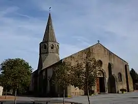 The church in Saint-Priest-en-Murat | |
Location of Saint-Priest-en-Murat | |
 Saint-Priest-en-Murat  Saint-Priest-en-Murat | |
| Coordinates: 46°21′00″N 2°54′47″E / 46.35°N 2.9131°E | |
| Country | France |
| Region | Auvergne-Rhône-Alpes |
| Department | Allier |
| Arrondissement | Montluçon |
| Canton | Commentry |
| Intercommunality | Commentry Montmarault Néris Communauté |
| Government | |
| • Mayor (2020–2026) | Luc Perrin[1] |
| Area 1 | 25.48 km2 (9.84 sq mi) |
| Population | 213 |
| • Density | 8.4/km2 (22/sq mi) |
| Time zone | UTC+01:00 (CET) |
| • Summer (DST) | UTC+02:00 (CEST) |
| INSEE/Postal code | 03256 /03390 |
| Elevation | 265–433 m (869–1,421 ft) (avg. 387 m or 1,270 ft) |
| 1 French Land Register data, which excludes lakes, ponds, glaciers > 1 km2 (0.386 sq mi or 247 acres) and river estuaries. | |
Saint-Priest-en-Murat (French pronunciation: [sɑ̃ pʁijɛ(st) ɑ̃ myʁa]) is a commune in the Allier department in Auvergne-Rhône-Alpes in central France.[3]
Population
| Year | Pop. | ±% p.a. |
|---|---|---|
| 1968 | 413 | — |
| 1975 | 321 | −3.54% |
| 1982 | 268 | −2.54% |
| 1990 | 243 | −1.22% |
| 1999 | 231 | −0.56% |
| 2007 | 254 | +1.19% |
| 2012 | 204 | −4.29% |
| 2017 | 223 | +1.80% |
| Source: INSEE[4] | ||
See also
References
- ↑ "Répertoire national des élus: les maires". data.gouv.fr, Plateforme ouverte des données publiques françaises (in French). 2 December 2020.
- ↑ "Populations légales 2021". The National Institute of Statistics and Economic Studies. 28 December 2023.
- ↑ INSEE commune file
- ↑ Population en historique depuis 1968, INSEE
Wikimedia Commons has media related to Saint-Priest-en-Murat.
This article is issued from Wikipedia. The text is licensed under Creative Commons - Attribution - Sharealike. Additional terms may apply for the media files.