Gilhac-et-Bruzac | |
|---|---|
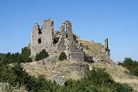 Ruins of the chateau of Pierregourde | |
Location of Gilhac-et-Bruzac | |
 Gilhac-et-Bruzac  Gilhac-et-Bruzac | |
| Coordinates: 44°51′38″N 4°43′47″E / 44.8606°N 4.7297°E | |
| Country | France |
| Region | Auvergne-Rhône-Alpes |
| Department | Ardèche |
| Arrondissement | Privas |
| Canton | Rhône-Eyrieux |
| Intercommunality | CA Privas Centre Ardèche |
| Government | |
| • Mayor (2020–2026) | Gilbert Bouvier[1] |
| Area 1 | 30.94 km2 (11.95 sq mi) |
| Population | 176 |
| • Density | 5.7/km2 (15/sq mi) |
| Time zone | UTC+01:00 (CET) |
| • Summer (DST) | UTC+02:00 (CEST) |
| INSEE/Postal code | 07094 /07800 |
| Elevation | 160–786 m (525–2,579 ft) (avg. 600 m or 2,000 ft) |
| 1 French Land Register data, which excludes lakes, ponds, glaciers > 1 km2 (0.386 sq mi or 247 acres) and river estuaries. | |
Gilhac-et-Bruzac is a commune in the Ardèche department in southern France.
Population
| Year | Pop. | ±% |
|---|---|---|
| 1962 | 88 | — |
| 1968 | 138 | +56.8% |
| 1975 | 108 | −21.7% |
| 1982 | 113 | +4.6% |
| 1990 | 138 | +22.1% |
| 1999 | 115 | −16.7% |
| 2008 | 150 | +30.4% |
See also
References
- ↑ "Répertoire national des élus: les maires". data.gouv.fr, Plateforme ouverte des données publiques françaises (in French). 9 August 2021.
- ↑ "Populations légales 2021". The National Institute of Statistics and Economic Studies. 28 December 2023.
Wikimedia Commons has media related to Gilhac-et-Bruzac.
This article is issued from Wikipedia. The text is licensed under Creative Commons - Attribution - Sharealike. Additional terms may apply for the media files.