Lachapelle-sous-Chanéac | |
|---|---|
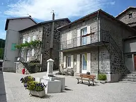 The centre of the village | |
Location of Lachapelle-sous-Chanéac | |
 Lachapelle-sous-Chanéac  Lachapelle-sous-Chanéac | |
| Coordinates: 44°56′53″N 4°19′54″E / 44.9481°N 4.3317°E | |
| Country | France |
| Region | Auvergne-Rhône-Alpes |
| Department | Ardèche |
| Arrondissement | Tournon-sur-Rhône |
| Canton | Haut-Eyrieux |
| Government | |
| • Mayor (2020–2026) | Michelle Thomas[1] |
| Area 1 | 8.94 km2 (3.45 sq mi) |
| Population | 161 |
| • Density | 18/km2 (47/sq mi) |
| Time zone | UTC+01:00 (CET) |
| • Summer (DST) | UTC+02:00 (CEST) |
| INSEE/Postal code | 07123 /07310 |
| Elevation | 594–1,121 m (1,949–3,678 ft) (avg. 600 m or 2,000 ft) |
| 1 French Land Register data, which excludes lakes, ponds, glaciers > 1 km2 (0.386 sq mi or 247 acres) and river estuaries. | |
Lachapelle-sous-Chanéac (French pronunciation: [laʃapɛl su ʃaneak], literally Lachapelle under Chanéac; Occitan: La Chapèla de Chanhac) is a commune in the Ardèche department in southern France.
Population
| Year | Pop. | ±% |
|---|---|---|
| 1962 | 183 | — |
| 1968 | 271 | +48.1% |
| 1975 | 232 | −14.4% |
| 1982 | 204 | −12.1% |
| 1990 | 162 | −20.6% |
| 1999 | 174 | +7.4% |
| 2008 | 204 | +17.2% |
See also
References
- ↑ "Répertoire national des élus: les maires". data.gouv.fr, Plateforme ouverte des données publiques françaises (in French). 9 August 2021.
- ↑ "Populations légales 2021". The National Institute of Statistics and Economic Studies. 28 December 2023.
Wikimedia Commons has media related to Lachapelle-sous-Chanéac.
This article is issued from Wikipedia. The text is licensed under Creative Commons - Attribution - Sharealike. Additional terms may apply for the media files.