Saint-Jean-Chambre | |
|---|---|
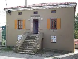 Town hall | |
Location of Saint-Jean-Chambre | |
 Saint-Jean-Chambre  Saint-Jean-Chambre | |
| Coordinates: 44°54′16″N 4°33′56″E / 44.9044°N 4.5656°E | |
| Country | France |
| Region | Auvergne-Rhône-Alpes |
| Department | Ardèche |
| Arrondissement | Privas |
| Canton | Rhône-Eyrieux |
| Intercommunality | CA Privas Centre Ardèche |
| Government | |
| • Mayor (2020–2026) | Gilles Durand[1] |
| Area 1 | 15.26 km2 (5.89 sq mi) |
| Population | 250 |
| • Density | 16/km2 (42/sq mi) |
| Time zone | UTC+01:00 (CET) |
| • Summer (DST) | UTC+02:00 (CEST) |
| INSEE/Postal code | 07244 /07240 |
| Elevation | 388–907 m (1,273–2,976 ft) (avg. 750 m or 2,460 ft) |
| 1 French Land Register data, which excludes lakes, ponds, glaciers > 1 km2 (0.386 sq mi or 247 acres) and river estuaries. | |
Saint-Jean-Chambre (French pronunciation: [sɛ̃ ʒɑ̃ ʃɑ̃bʁ]; Occitan: Sant Jean Chambre) is a commune in the Ardèche department in southern France.
Population
| Year | Pop. | ±% |
|---|---|---|
| 1962 | 301 | — |
| 1968 | 333 | +10.6% |
| 1975 | 284 | −14.7% |
| 1982 | 260 | −8.5% |
| 1990 | 235 | −9.6% |
| 1999 | 246 | +4.7% |
| 2008 | 252 | +2.4% |
See also
References
- ↑ "Répertoire national des élus: les maires". data.gouv.fr, Plateforme ouverte des données publiques françaises (in French). 9 August 2021.
- ↑ "Populations légales 2021". The National Institute of Statistics and Economic Studies. 28 December 2023.
Wikimedia Commons has media related to Saint-Jean-Chambre.
This article is issued from Wikipedia. The text is licensed under Creative Commons - Attribution - Sharealike. Additional terms may apply for the media files.