Le Passage | |
|---|---|
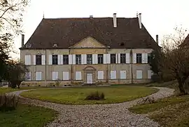 Chateau | |
Location of Le Passage | |
 Le Passage  Le Passage | |
| Coordinates: 45°32′00″N 5°30′46″E / 45.5333°N 5.5128°E | |
| Country | France |
| Region | Auvergne-Rhône-Alpes |
| Department | Isère |
| Arrondissement | La Tour-du-Pin |
| Canton | La Tour-du-Pin |
| Government | |
| • Mayor (2020–2026) | Laurent Michel[1] |
| Area 1 | 6.68 km2 (2.58 sq mi) |
| Population | 937 |
| • Density | 140/km2 (360/sq mi) |
| Time zone | UTC+01:00 (CET) |
| • Summer (DST) | UTC+02:00 (CEST) |
| INSEE/Postal code | 38296 /38490 |
| Elevation | 365–521 m (1,198–1,709 ft) (avg. 471 m or 1,545 ft) |
| 1 French Land Register data, which excludes lakes, ponds, glaciers > 1 km2 (0.386 sq mi or 247 acres) and river estuaries. | |
Le Passage (French pronunciation: [lə pasaʒ]) is a commune in the Isère department in southeastern France.[3]
Geography
The Bourbre forms the commune's southeastern border.
Population
| Year | Pop. | ±% p.a. |
|---|---|---|
| 1968 | 343 | — |
| 1975 | 339 | −0.17% |
| 1982 | 431 | +3.49% |
| 1990 | 516 | +2.28% |
| 1999 | 648 | +2.56% |
| 2009 | 761 | +1.62% |
| 2014 | 783 | +0.57% |
| 2020 | 918 | +2.69% |
| Source: INSEE[4] | ||
See also
References
- ↑ "Répertoire national des élus: les maires". data.gouv.fr, Plateforme ouverte des données publiques françaises (in French). 2 December 2020.
- ↑ "Populations légales 2021". The National Institute of Statistics and Economic Studies. 28 December 2023.
- ↑ INSEE commune file
- ↑ Population en historique depuis 1968, INSEE
Wikimedia Commons has media related to Le Passage (Isère).
This article is issued from Wikipedia. The text is licensed under Creative Commons - Attribution - Sharealike. Additional terms may apply for the media files.