Le Teilleul | |
|---|---|
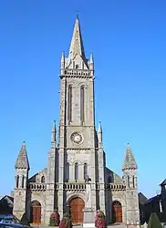 The church in Le Teilleul | |
.svg.png.webp) Coat of arms | |
Location of Le Teilleul | |
 Le Teilleul  Le Teilleul | |
| Coordinates: 48°32′21″N 0°52′25″W / 48.5393°N 0.8735°W | |
| Country | France |
| Region | Normandy |
| Department | Manche |
| Arrondissement | Avranches |
| Canton | Le Mortainais |
| Intercommunality | CA Mont-Saint-Michel-Normandie |
| Government | |
| • Mayor (2020–2026) | Véronique Künkel[1] |
| Area 1 | 66.89 km2 (25.83 sq mi) |
| Population | 1,677 |
| • Density | 25/km2 (65/sq mi) |
| Demonym | Teilleulais et Teilleulaise |
| Time zone | UTC+01:00 (CET) |
| • Summer (DST) | UTC+02:00 (CEST) |
| INSEE/Postal code | 50591 /50640 |
| Elevation | 103–222 m (338–728 ft) (avg. 212 m or 696 ft) |
| 1 French Land Register data, which excludes lakes, ponds, glaciers > 1 km2 (0.386 sq mi or 247 acres) and river estuaries. | |
Le Teilleul (French pronunciation: [lə.tɛj'œl]) is a commune in the Manche department in Normandy in north-western France. On 1 January 2016, the former communes of Ferrières, Heussé, Husson and Sainte-Marie-du-Bois were merged into Le Teilleul.[3]
Heraldry
Arms of Le Teilleul |
The arms of Le Teilleul are blazoned : Azure, 3 horseshoes argent.
|
See also
References
- ↑ "Répertoire national des élus: les maires" (in French). data.gouv.fr, Plateforme ouverte des données publiques françaises. 13 September 2022.
- ↑ "Populations légales 2021". The National Institute of Statistics and Economic Studies. 28 December 2023.
- ↑ Arrêté préfectoral 9 December 2015 (in French)
Wikimedia Commons has media related to Le Teilleul.
This article is issued from Wikipedia. The text is licensed under Creative Commons - Attribution - Sharealike. Additional terms may apply for the media files.