Saint-Fromond | |
|---|---|
 The church in Saint-Fromond | |
 Coat of arms | |
Location of Saint-Fromond | |
 Saint-Fromond  Saint-Fromond | |
| Coordinates: 49°13′17″N 1°05′24″W / 49.2214°N 1.09°W | |
| Country | France |
| Region | Normandy |
| Department | Manche |
| Arrondissement | Saint-Lô |
| Canton | Pont-Hébert |
| Intercommunality | Saint-Lô Agglo |
| Government | |
| • Mayor (2020–2026) | Dominique Quinette[1] |
| Area 1 | 15.52 km2 (5.99 sq mi) |
| Population | 753 |
| • Density | 49/km2 (130/sq mi) |
| Demonym | Fromondais |
| Time zone | UTC+01:00 (CET) |
| • Summer (DST) | UTC+02:00 (CEST) |
| INSEE/Postal code | 50468 /50620 |
| Elevation | 0–53 m (0–174 ft) (avg. 15 m or 49 ft) |
| 1 French Land Register data, which excludes lakes, ponds, glaciers > 1 km2 (0.386 sq mi or 247 acres) and river estuaries. | |
Saint-Fromond (French pronunciation: [sɛ̃ fʁɔmɔ̃]) is a commune in the Manche department in Normandy in north-western France.[3]
Heraldry
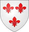
Arms of Saint-Fromond |
The arms of Saint-Fromond are blazoned : Argent, 3 fleurs de lys gules.
|
See also
References
- ↑ "Répertoire national des élus: les maires". data.gouv.fr, Plateforme ouverte des données publiques françaises (in French). 2 December 2020.
- ↑ "Populations légales 2021". The National Institute of Statistics and Economic Studies. 28 December 2023.
- ↑ INSEE commune file
Wikimedia Commons has media related to Saint-Fromond.
This article is issued from Wikipedia. The text is licensed under Creative Commons - Attribution - Sharealike. Additional terms may apply for the media files.