Percy-en-Normandie | |
|---|---|
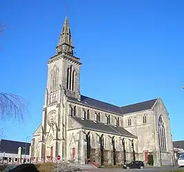 The church in Percy | |
Location of Percy-en-Normandie | |
 Percy-en-Normandie  Percy-en-Normandie | |
| Coordinates: 48°54′58″N 1°11′24″W / 48.916°N 1.190°W | |
| Country | France |
| Region | Normandy |
| Department | Manche |
| Arrondissement | Saint-Lô |
| Canton | Villedieu-les-Poêles-Rouffigny |
| Area 1 | 48.32 km2 (18.66 sq mi) |
| Population | 2,614 |
| • Density | 54/km2 (140/sq mi) |
| Time zone | UTC+01:00 (CET) |
| • Summer (DST) | UTC+02:00 (CEST) |
| INSEE/Postal code | 50393 /50410 |
| 1 French Land Register data, which excludes lakes, ponds, glaciers > 1 km2 (0.386 sq mi or 247 acres) and river estuaries. | |
Percy-en-Normandie (French pronunciation: [pɛʁsi ɑ̃ nɔʁmɑ̃di], literally Percy in Normandy) is a commune in the department of Manche, northwestern France. The municipality was established on 1 January 2016 by merger of the former communes of Percy and Le Chefresne.[2]
Population
| Year | Pop. | ±% p.a. |
|---|---|---|
| 1968 | 2,823 | — |
| 1975 | 2,579 | −1.28% |
| 1982 | 2,555 | −0.13% |
| 1990 | 2,407 | −0.74% |
| 1999 | 2,408 | +0.00% |
| 2007 | 2,516 | +0.55% |
| 2012 | 2,600 | +0.66% |
| 2017 | 2,583 | −0.13% |
| Source: INSEE[3] | ||
See also
References
Wikimedia Commons has media related to Percy-en-Normandie.
- ↑ "Populations légales 2021". The National Institute of Statistics and Economic Studies. 28 December 2023.
- ↑ Arrêté préfectoral 4 December 2015 (in French)
- ↑ Population en historique depuis 1968, INSEE
This article is issued from Wikipedia. The text is licensed under Creative Commons - Attribution - Sharealike. Additional terms may apply for the media files.