Oberhausbergen
| |
|---|---|
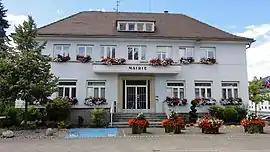 The town hall in Oberhausbergen | |
 Coat of arms | |
Location of Oberhausbergen | |
 Oberhausbergen  Oberhausbergen | |
| Coordinates: 48°36′26″N 7°41′10″E / 48.6072°N 7.6861°E | |
| Country | France |
| Region | Grand Est |
| Department | Bas-Rhin |
| Arrondissement | Strasbourg |
| Canton | Hœnheim |
| Intercommunality | Eurométropole de Strasbourg |
| Government | |
| • Mayor (2020–2026) | Cécile Delattre[1] |
| Area 1 | 3.79 km2 (1.46 sq mi) |
| Population | 5,556 |
| • Density | 1,500/km2 (3,800/sq mi) |
| Time zone | UTC+01:00 (CET) |
| • Summer (DST) | UTC+02:00 (CEST) |
| INSEE/Postal code | 67343 /67205 |
| Elevation | 143–187 m (469–614 ft) |
| 1 French Land Register data, which excludes lakes, ponds, glaciers > 1 km2 (0.386 sq mi or 247 acres) and river estuaries. | |
Oberhausbergen (Alsatian: Ìwerhüsbarje or Owerhüsbàrje) is a commune in the Bas-Rhin department in Grand Est in north-eastern France.[3] It is a northwestern suburb of Strasbourg.
Population
| Year | Pop. | ±% p.a. |
|---|---|---|
| 1968 | 1,818 | — |
| 1975 | 2,103 | +2.10% |
| 1982 | 2,014 | −0.62% |
| 1990 | 3,020 | +5.19% |
| 1999 | 4,518 | +4.58% |
| 2007 | 4,546 | +0.08% |
| 2012 | 4,818 | +1.17% |
| 2017 | 5,381 | +2.23% |
| Source: INSEE[4] | ||
See also
References
- ↑ "Répertoire national des élus: les maires" (in French). data.gouv.fr, Plateforme ouverte des données publiques françaises. 13 September 2022.
- ↑ "Populations légales 2021". The National Institute of Statistics and Economic Studies. 28 December 2023.
- ↑ INSEE commune file
- ↑ Population en historique depuis 1968, INSEE
Wikimedia Commons has media related to Oberhausbergen.
This article is issued from Wikipedia. The text is licensed under Creative Commons - Attribution - Sharealike. Additional terms may apply for the media files.