Uhrwiller | |
|---|---|
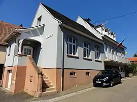 The town hall in Uhrwiller | |
 Coat of arms | |
Location of Uhrwiller | |
 Uhrwiller  Uhrwiller | |
| Coordinates: 48°52′42″N 7°34′45″E / 48.8783°N 7.5792°E | |
| Country | France |
| Region | Grand Est |
| Department | Bas-Rhin |
| Arrondissement | Haguenau-Wissembourg |
| Canton | Reichshoffen |
| Intercommunality | CA Haguenau |
| Government | |
| • Mayor (2020–2026) | Michel Fichter[1] |
| Area 1 | 11.02 km2 (4.25 sq mi) |
| Population | 708 |
| • Density | 64/km2 (170/sq mi) |
| Time zone | UTC+01:00 (CET) |
| • Summer (DST) | UTC+02:00 (CEST) |
| INSEE/Postal code | 67498 /67350 |
| Elevation | 172–266 m (564–873 ft) |
| 1 French Land Register data, which excludes lakes, ponds, glaciers > 1 km2 (0.386 sq mi or 247 acres) and river estuaries. | |
Uhrwiller (German: Uhrweiler) is a commune in the Bas-Rhin department in Grand Est in north-eastern France.[3] The archaeologist Ernest Will (1913–1997) was born in Uhrwiller.
It is about 45 km (28 mi) north and slightly west of Strasbourg.[4]
Population
The demography of Uhrwiller has been quite stable for some years.
| Year | Pop. | ±% p.a. |
|---|---|---|
| 1968 | 704 | — |
| 1975 | 681 | −0.47% |
| 1982 | 704 | +0.48% |
| 1990 | 715 | +0.19% |
| 1999 | 697 | −0.28% |
| 2007 | 687 | −0.18% |
| 2012 | 702 | +0.43% |
| 2017 | 706 | +0.11% |
| Source: INSEE[5] | ||
See also
References
- ↑ "Répertoire national des élus: les maires". data.gouv.fr, Plateforme ouverte des données publiques françaises (in French). 2 December 2020.
- ↑ "Populations légales 2021". The National Institute of Statistics and Economic Studies. 28 December 2023.
- ↑ INSEE commune file
- ↑ Map on Google Maps
- ↑ Population en historique depuis 1968, INSEE
Wikimedia Commons has media related to Uhrwiller.
This article is issued from Wikipedia. The text is licensed under Creative Commons - Attribution - Sharealike. Additional terms may apply for the media files.