Saint-Avit-le-Pauvre | |
|---|---|
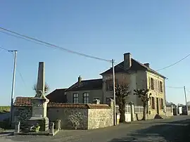 The town hall in Saint-Avit-le-Pauvre | |
Location of Saint-Avit-le-Pauvre | |
 Saint-Avit-le-Pauvre  Saint-Avit-le-Pauvre | |
| Coordinates: 45°59′48″N 2°02′42″E / 45.9967°N 2.045°E | |
| Country | France |
| Region | Nouvelle-Aquitaine |
| Department | Creuse |
| Arrondissement | Guéret |
| Canton | Ahun |
| Intercommunality | CC Creuse Sud Ouest |
| Government | |
| • Mayor (2020–2026) | Gilles Depatureaux[1] |
| Area 1 | 4.99 km2 (1.93 sq mi) |
| Population | 82 |
| • Density | 16/km2 (43/sq mi) |
| Time zone | UTC+01:00 (CET) |
| • Summer (DST) | UTC+02:00 (CEST) |
| INSEE/Postal code | 23183 /23480 |
| Elevation | 529–618 m (1,736–2,028 ft) (avg. 570 m or 1,870 ft) |
| 1 French Land Register data, which excludes lakes, ponds, glaciers > 1 km2 (0.386 sq mi or 247 acres) and river estuaries. | |
Saint-Avit-le-Pauvre (French pronunciation: [sɛ̃.t‿avi lə povʁ]; Occitan: Sent Avit le Paubre) is a commune in the Creuse department in central France.
Population
| Year | Pop. | ±% |
|---|---|---|
| 1962 | 99 | — |
| 1968 | 104 | +5.1% |
| 1975 | 91 | −12.5% |
| 1982 | 76 | −16.5% |
| 1990 | 69 | −9.2% |
| 1999 | 80 | +15.9% |
| 2008 | 75 | −6.2% |
See also
References
- ↑ "Répertoire national des élus: les maires". data.gouv.fr, Plateforme ouverte des données publiques françaises (in French). 2 December 2020.
- ↑ "Populations légales 2021". The National Institute of Statistics and Economic Studies. 28 December 2023.
Wikimedia Commons has media related to Saint-Avit-le-Pauvre.
This article is issued from Wikipedia. The text is licensed under Creative Commons - Attribution - Sharealike. Additional terms may apply for the media files.