Saint-Maurice-la-Souterraine | |
|---|---|
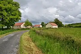 Buildings in Saint-Maurice-la-Souterraine | |
Location of Saint-Maurice-la-Souterraine | |
 Saint-Maurice-la-Souterraine  Saint-Maurice-la-Souterraine | |
| Coordinates: 46°12′54″N 1°25′55″E / 46.215°N 1.4319°E | |
| Country | France |
| Region | Nouvelle-Aquitaine |
| Department | Creuse |
| Arrondissement | Guéret |
| Canton | La Souterraine |
| Intercommunality | CC Pays Sostranien |
| Government | |
| • Mayor (2020–2026) | Évelyne Augros[1] |
| Area 1 | 39.72 km2 (15.34 sq mi) |
| Population | 1,158 |
| • Density | 29/km2 (76/sq mi) |
| Time zone | UTC+01:00 (CET) |
| • Summer (DST) | UTC+02:00 (CEST) |
| INSEE/Postal code | 23219 /23300 |
| Elevation | 300–422 m (984–1,385 ft) (avg. 359 m or 1,178 ft) |
| 1 French Land Register data, which excludes lakes, ponds, glaciers > 1 km2 (0.386 sq mi or 247 acres) and river estuaries. | |
Saint-Maurice-la-Souterraine (French: [sɛ̃ mɔʁis la sutɛʁɛn]; Occitan: Sent Maurici) is a commune in the Creuse department in central France.
Geography
The river Semme flows west through the commune's southern part.
The river Brame flows west through the commune's northern part.
Population
| Year | Pop. | ±% |
|---|---|---|
| 1962 | 1,183 | — |
| 1968 | 1,246 | +5.3% |
| 1975 | 1,117 | −10.4% |
| 1982 | 1,082 | −3.1% |
| 1990 | 1,089 | +0.6% |
| 1999 | 1,048 | −3.8% |
| 2008 | 1,201 | +14.6% |
See also
References
- ↑ "Répertoire national des élus: les maires" (in French). data.gouv.fr, Plateforme ouverte des données publiques françaises. 13 September 2022.
- ↑ "Populations légales 2021". The National Institute of Statistics and Economic Studies. 28 December 2023.
Wikimedia Commons has media related to Saint-Maurice-la-Souterraine.
This article is issued from Wikipedia. The text is licensed under Creative Commons - Attribution - Sharealike. Additional terms may apply for the media files.