Selles
Zele | |
|---|---|
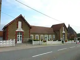 The town hall and school of Selles | |
.svg.png.webp) Coat of arms | |
Location of Selles | |
 Selles  Selles | |
| Coordinates: 50°42′01″N 1°53′47″E / 50.7003°N 1.8964°E | |
| Country | France |
| Region | Hauts-de-France |
| Department | Pas-de-Calais |
| Arrondissement | Boulogne-sur-Mer |
| Canton | Desvres |
| Intercommunality | CC Desvres-Samer |
| Government | |
| • Mayor (2020–2026) | Fabienne Fourrier[1] |
| Area 1 | 6.35 km2 (2.45 sq mi) |
| Population | 312 |
| • Density | 49/km2 (130/sq mi) |
| Time zone | UTC+01:00 (CET) |
| • Summer (DST) | UTC+02:00 (CEST) |
| INSEE/Postal code | 62786 /62240 |
| Elevation | 47–96 m (154–315 ft) (avg. 74 m or 243 ft) |
| 1 French Land Register data, which excludes lakes, ponds, glaciers > 1 km2 (0.386 sq mi or 247 acres) and river estuaries. | |
Selles (French pronunciation: [sɛl]; West Flemish: Zele) is a commune in the Pas-de-Calais department in the Hauts-de-France region of France.[3]
Geography
Selles is situated some 14 miles (23 km) east of Boulogne, at the junction of the D215 and D254 roads, by the banks of the Liane river.
Population
| Year | Pop. | ±% p.a. |
|---|---|---|
| 1968 | 314 | — |
| 1975 | 304 | −0.46% |
| 1982 | 296 | −0.38% |
| 1990 | 277 | −0.83% |
| 1999 | 286 | +0.36% |
| 2007 | 320 | +1.41% |
| 2012 | 323 | +0.19% |
| 2017 | 333 | +0.61% |
| Source: INSEE[4] | ||
Places of interest
See also
References
- ↑ "Répertoire national des élus: les maires" (in French). data.gouv.fr, Plateforme ouverte des données publiques françaises. 13 September 2022.
- ↑ "Populations légales 2021". The National Institute of Statistics and Economic Studies. 28 December 2023.
- ↑ INSEE commune file
- ↑ Population en historique depuis 1968, INSEE
Wikimedia Commons has media related to Selles (Pas-de-Calais).
This article is issued from Wikipedia. The text is licensed under Creative Commons - Attribution - Sharealike. Additional terms may apply for the media files.