Bowen
Queensland
Location within Queensland
Lands administrative divisions around Bowen:
Yarrol Flinders Cook
Yarrol Bowen Cook
Wicklow Mackenzie Cook

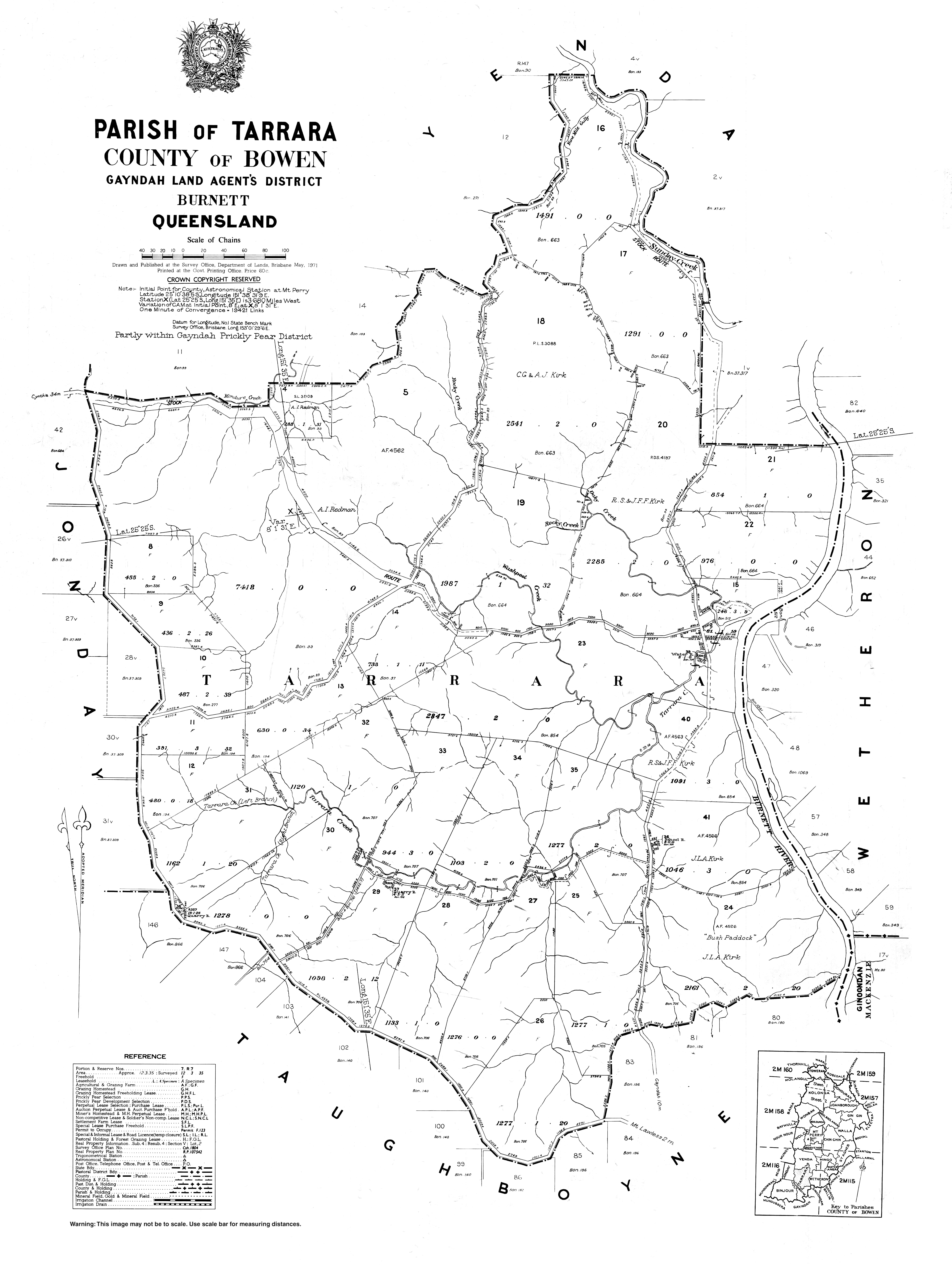
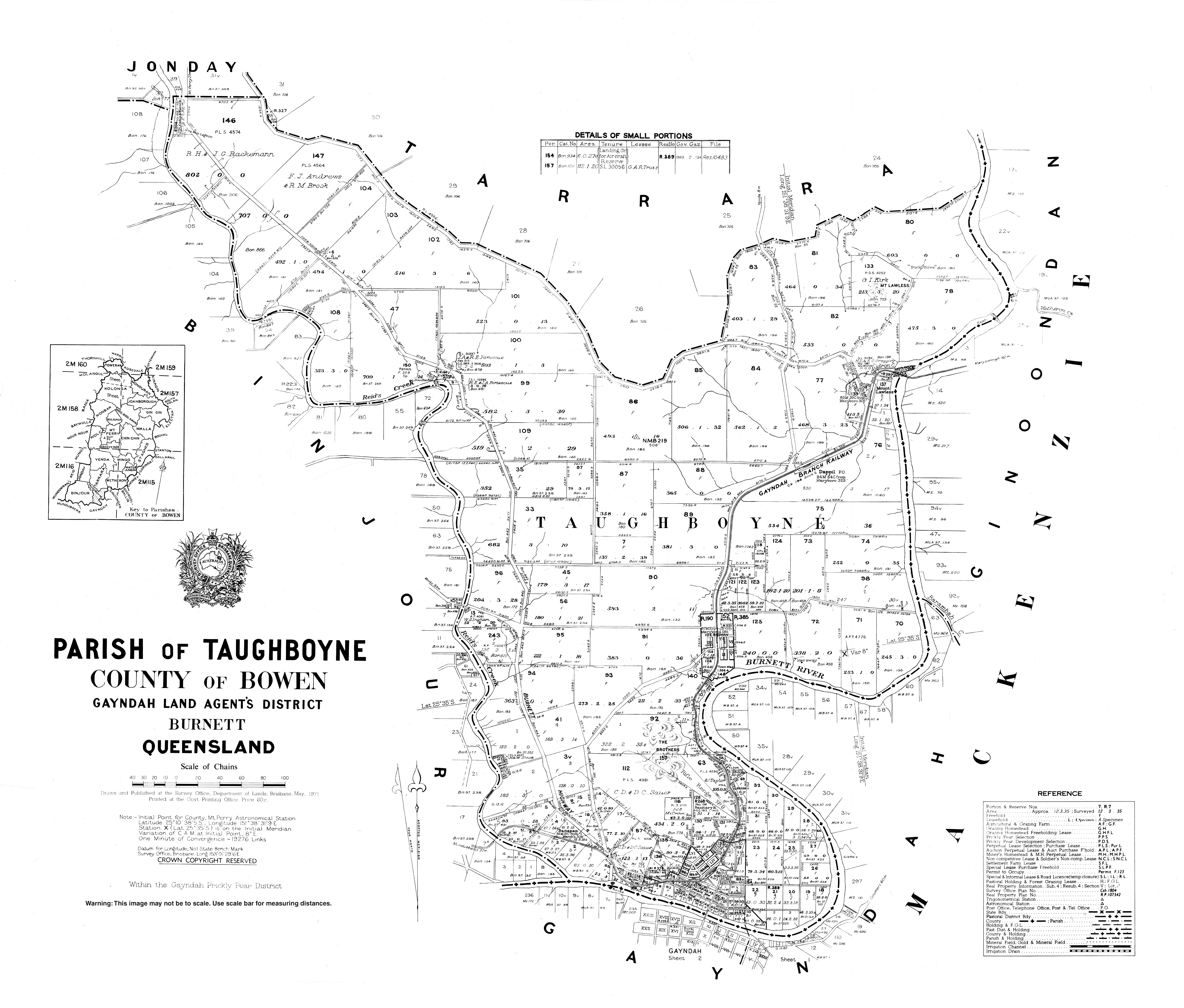
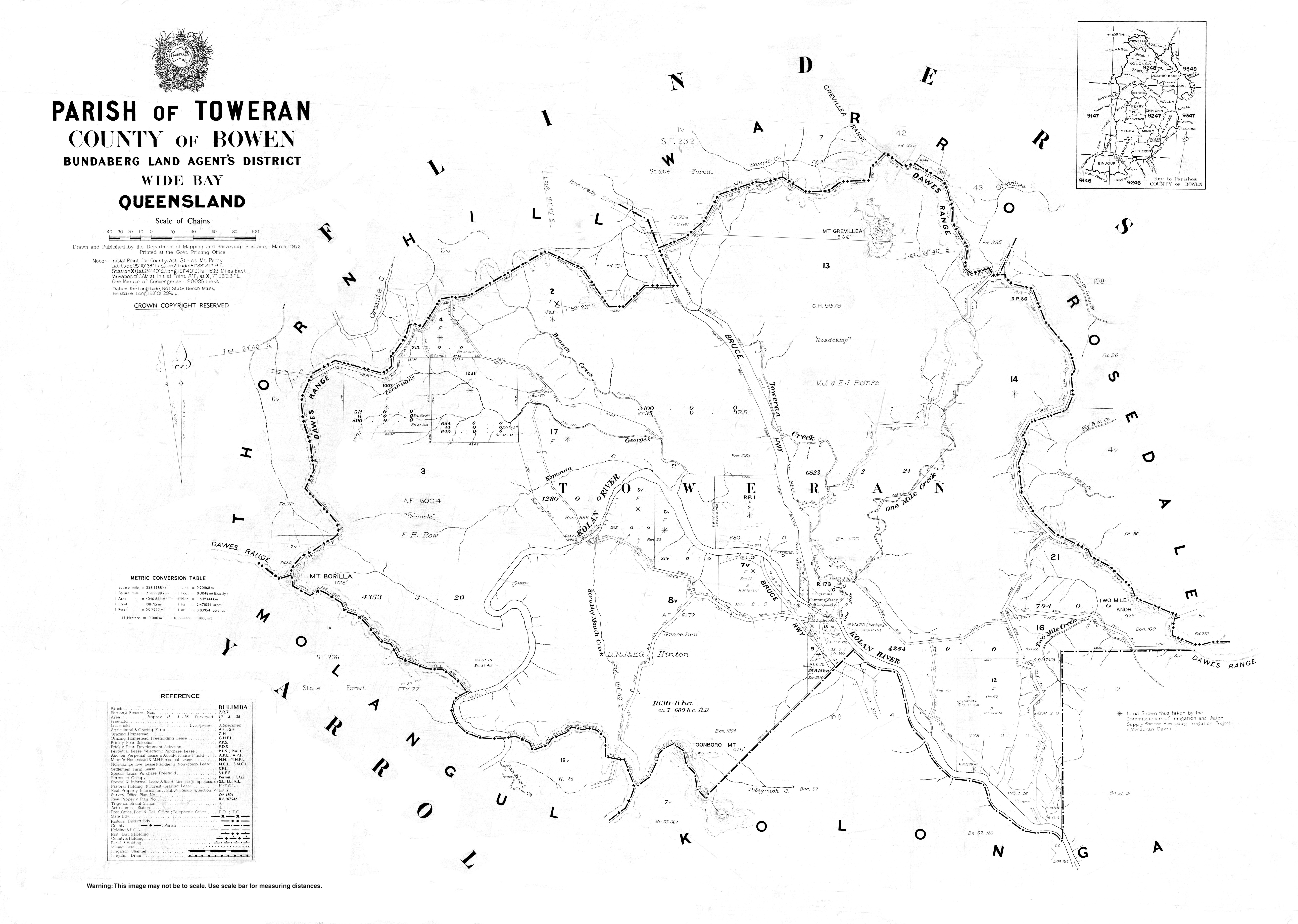
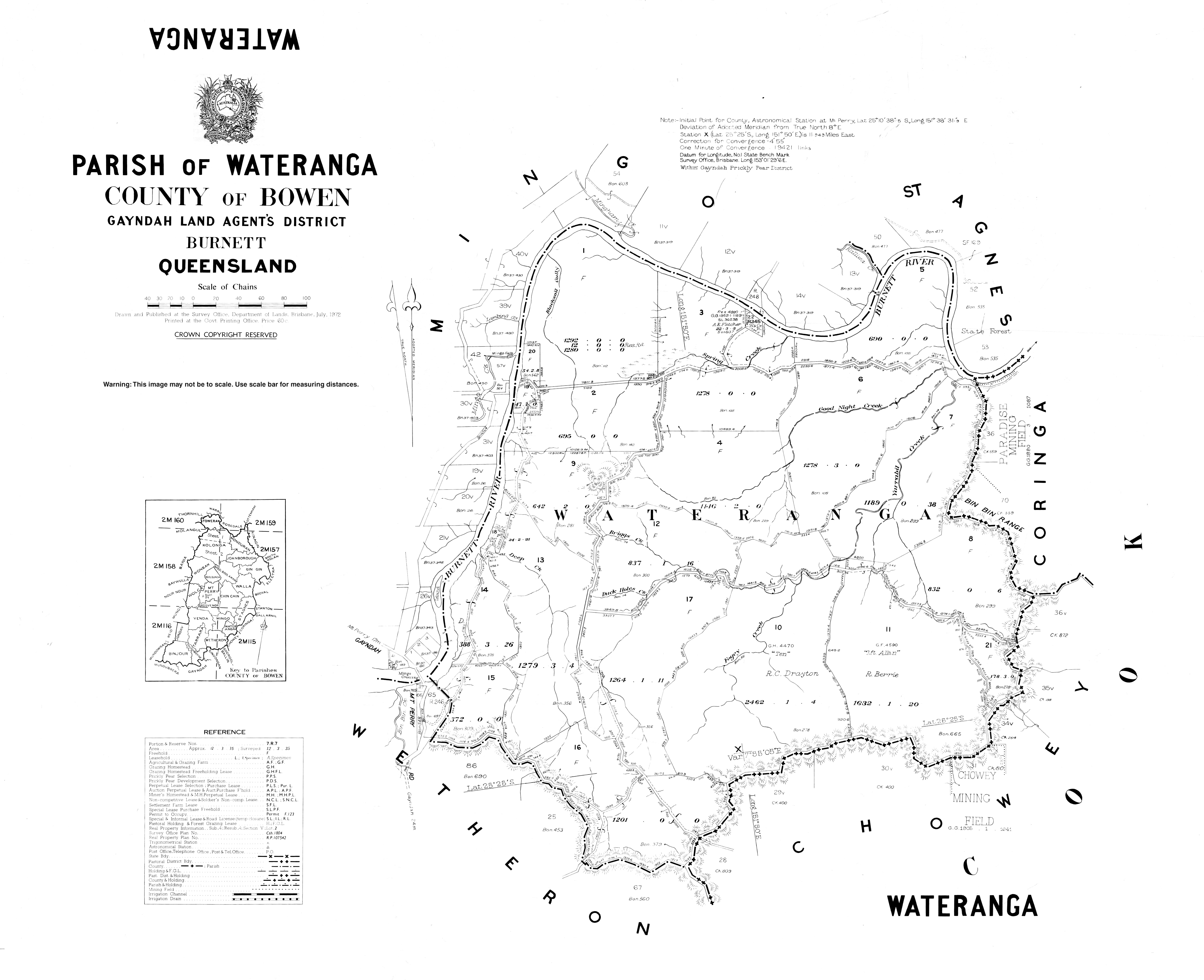
The County of Bowen is a county (a cadastral division) in Queensland, Australia, located in the Wide Bay–Burnett region to the west of Bundaberg. It was named in honour of Sir George Ferguson Bowen, the first Governor of Queensland.[1][2] On 7 March 1901, the Governor issued a proclamation legally dividing Queensland into counties under the Land Act 1897.[3] Its schedule described Bowen thus:

Bounded on the east by the county of Cook; on the south by the county of Mackenzie; on the west by [...] the parishes of Mundowran, Boomerang, Binjour, Jonday, Yenda, Wolca, Wombah, Kolonga and Toweran; and on the north by the northern boundaries of the parishes of Toweran, Kolonga and Manduran.

Parishes

Bowen is divided into parishes, as listed below:

ParishLGACoordinatesTowns Parish map
BinjourNorth Burnett25°33′S 151°29′E / 25.550°S 151.483°E / -25.550; 151.483 (Binjour Parish)Binjour 1973 map
BoolbundaBundaberg25°03′S 151°42′E / 25.050°S 151.700°E / -25.050; 151.700 (Boolbunda Parish)Boolboonda 1968 map
Chin ChinNorth Burnett25°11′S 151°50′E / 25.183°S 151.833°E / -25.183; 151.833 (Chin Chin Parish) 1876 map
Gin GinBundaberg25°00′S 152°00′E / 25.000°S 152.000°E / -25.000; 152.000 (Gin Gin Parish)Gin Gin, Bullyard, Tirroan 1972 map
GrosvenorNorth Burnett25°14′S 151°41′E / 25.233°S 151.683°E / -25.233; 151.683 (Grosvenor Parish) 1969 map
JoanboroughBundaberg24°56′S 151°54′E / 24.933°S 151.900°E / -24.933; 151.900 (Joanborough Parish) 1971 map
JondayNorth Burnett25°25′S 151°30′E / 25.417°S 151.500°E / -25.417; 151.500 (Jonday Parish) 1969 map
KolongaBundaberg24°51′S 151°43′E / 24.850°S 151.717°E / -24.850; 151.717 (Kolonga Parish)Kolonga 1977 map (sheet 2 only)
MingoNorth Burnett25°20′S 151°46′E / 25.333°S 151.767°E / -25.333; 151.767 (Mingo Parish) 1967 map
MonduranBundaberg24°49′S 151°54′E / 24.817°S 151.900°E / -24.817; 151.900 (Monduran Parish)Monduran 1971 map
MoolboolamanBundaberg25°01′S 151°49′E / 25.017°S 151.817°E / -25.017; 151.817 (Moolboolaman Parish)Moolboolaman 1972 map
Mount PerryNorth Burnett25°09′S 151°42′E / 25.150°S 151.700°E / -25.150; 151.700 (Mount Perry Parish)Mount Perry 1971 map
St AgnesBundaberg25°16′S 151°57′E / 25.267°S 151.950°E / -25.267; 151.950 (St Agnes Parish) 1972 map
TarraraNorth Burnett25°27′S 151°37′E / 25.450°S 151.617°E / -25.450; 151.617 (Tarrara Parish)Yenda 1971 map
TaughboyneNorth Burnett25°33′S 151°37′E / 25.550°S 151.617°E / -25.550; 151.617 (Taughboyne Parish)Gayndah (N), Ideraway 1971 map
ToweranGladstone24°42′S 151°41′E / 24.700°S 151.683°E / -24.700; 151.683 (Toweran Parish) 1976 map
WallaBundaberg25°06′S 151°56′E / 25.100°S 151.933°E / -25.100; 151.933 (Walla Parish)Wallaville 1971 map
WaterangaNorth Burnett25°23′S 151°50′E / 25.383°S 151.833°E / -25.383; 151.833 (Wateranga Parish) 1972 map
WetheronNorth Burnett25°27′S 151°44′E / 25.450°S 151.733°E / -25.450; 151.733 (Wetheron Parish) 1971 map
WolcaNorth Burnett25°11′S 151°34′E / 25.183°S 151.567°E / -25.183; 151.567 (Wolca Parish) 1973 map
WonbahBundaberg25°01′S 151°37′E / 25.017°S 151.617°E / -25.017; 151.617 (Wonbah Parish) 1971 map
YendaNorth Burnett25°20′S 151°38′E / 25.333°S 151.633°E / -25.333; 151.633 (Yenda Parish) 1966 map

References

  1. "Bowen (entry 4101)". Queensland Place Names. Queensland Government. Retrieved 8 September 2015.
  2. Wide Bay/Burnett Districts, County of Bowen Maps – D2 Series at Queensland Archives.
  3. "A Proclamation". Queensland Government Gazette. Vol. 75. 8 March 1901. pp. 967–980.

25°11′S 151°39′E / 25.183°S 151.650°E / -25.183; 151.650

This article is issued from Wikipedia. The text is licensed under Creative Commons - Attribution - Sharealike. Additional terms may apply for the media files.