Dobrochov | |
|---|---|
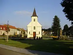 Centre of Dobrochov | |
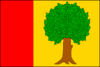 Flag 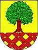 Coat of arms | |
 Dobrochov Location in the Czech Republic | |
| Coordinates: 49°23′9″N 17°6′20″E / 49.38583°N 17.10556°E | |
| Country | |
| Region | Olomouc |
| District | Prostějov |
| First mentioned | 1141 |
| Area | |
| • Total | 2.53 km2 (0.98 sq mi) |
| Elevation | 237 m (778 ft) |
| Population (2023-01-01)[1] | |
| • Total | 357 |
| • Density | 140/km2 (370/sq mi) |
| Time zone | UTC+1 (CET) |
| • Summer (DST) | UTC+2 (CEST) |
| Postal code | 798 07 |
| Website | www |
Dobrochov is a municipality and village in Prostějov District in the Olomouc Region of the Czech Republic. It has about 400 inhabitants.
Geography
Dobrochov is located about 9 km (6 mi) south of Prostějov and 24 km (15 mi) southwest of Olomouc. It lies in an agricultural landscape in the Upper Morava Valley. The highest point is a contour line at 298 m (978 ft) above sea level.
Transport
The D46 motorway passes through the municipality.
References
Wikimedia Commons has media related to Dobrochov.
This article is issued from Wikipedia. The text is licensed under Creative Commons - Attribution - Sharealike. Additional terms may apply for the media files.