Vrbátky | |
|---|---|
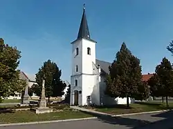 Chapel of Saint Florian | |
 Flag  Coat of arms | |
 Vrbátky Location in the Czech Republic | |
| Coordinates: 49°30′29″N 17°12′0″E / 49.50806°N 17.20000°E | |
| Country | |
| Region | Olomouc |
| District | Prostějov |
| First mentioned | 1359 |
| Area | |
| • Total | 13.26 km2 (5.12 sq mi) |
| Elevation | 213 m (699 ft) |
| Population (2023-01-01)[1] | |
| • Total | 1,770 |
| • Density | 130/km2 (350/sq mi) |
| Time zone | UTC+1 (CET) |
| • Summer (DST) | UTC+2 (CEST) |
| Postal codes | 798 12, 798 13 |
| Website | www |
Vrbátky is a municipality and village in Prostějov District in the Olomouc Region of the Czech Republic. It has about 1,800 inhabitants.
Vrbátky lies approximately 8 kilometres (5 mi) north-east of Prostějov, 11 km (7 mi) south of Olomouc, and 210 km (130 mi) east of Prague.
Administrative parts
Villages of Dubany and Štětovice are administrative parts of Vrbátky.
Economy
A sugar factory has been in Vrbátky since 1870. It was the first sugar factory in Moravia.[2]
References
- ↑ "Population of Municipalities – 1 January 2023". Czech Statistical Office. 2023-05-23.
- ↑ "O cukrovaru" (in Czech). Cukrovar Vrbátky a.s. Retrieved 2020-10-11.
Wikimedia Commons has media related to Vrbátky.
This article is issued from Wikipedia. The text is licensed under Creative Commons - Attribution - Sharealike. Additional terms may apply for the media files.