Gallardon | |
|---|---|
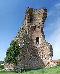 Ruined tower | |
.svg.png.webp) Coat of arms | |
Location of Gallardon | |
 Gallardon 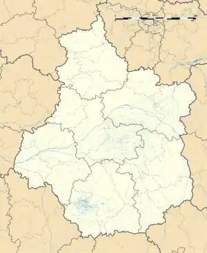 Gallardon | |
| Coordinates: 48°31′32″N 1°41′27″E / 48.5256°N 1.6908°E | |
| Country | France |
| Region | Centre-Val de Loire |
| Department | Eure-et-Loir |
| Arrondissement | Chartres |
| Canton | Auneau |
| Government | |
| • Mayor (2020–2026) | Yves Marie[1] |
| Area 1 | 11.27 km2 (4.35 sq mi) |
| Population | 3,589 |
| • Density | 320/km2 (820/sq mi) |
| Time zone | UTC+01:00 (CET) |
| • Summer (DST) | UTC+02:00 (CEST) |
| INSEE/Postal code | 28168 /28320 |
| Elevation | 107–158 m (351–518 ft) (avg. 140 m or 460 ft) |
| 1 French Land Register data, which excludes lakes, ponds, glaciers > 1 km2 (0.386 sq mi or 247 acres) and river estuaries. | |
Gallardon (French pronunciation: [ɡalaʁdɔ̃]) is a commune in the Eure-et-Loir department in northern France.
Population
| Year | Pop. | ±% p.a. |
|---|---|---|
| 1968 | 1,850 | — |
| 1975 | 2,076 | +1.66% |
| 1982 | 2,303 | +1.49% |
| 1990 | 2,576 | +1.41% |
| 1999 | 3,510 | +3.50% |
| 2007 | 3,424 | −0.31% |
| 2012 | 3,529 | +0.61% |
| 2017 | 3,669 | +0.78% |
| Source: INSEE[3] | ||
See also
References
- ↑ "Répertoire national des élus: les maires". data.gouv.fr, Plateforme ouverte des données publiques françaises (in French). 2 December 2020.
- ↑ "Populations légales 2021". The National Institute of Statistics and Economic Studies. 28 December 2023.
- ↑ Population en historique depuis 1968, INSEE
Wikimedia Commons has media related to Gallardon.
This article is issued from Wikipedia. The text is licensed under Creative Commons - Attribution - Sharealike. Additional terms may apply for the media files.