Londrina–Governador José Richa Airport Aeroporto de Londrina–Governador José Richa | |||||||||||
|---|---|---|---|---|---|---|---|---|---|---|---|
 | |||||||||||
| Summary | |||||||||||
| Airport type | Public | ||||||||||
| Operator | |||||||||||
| Serves | Londrina | ||||||||||
| Time zone | BRT (UTC−03:00) | ||||||||||
| Elevation AMSL | 569 m / 1,867 ft | ||||||||||
| Coordinates | 23°19′49″S 051°08′12″W / 23.33028°S 51.13667°W | ||||||||||
| Map | |||||||||||
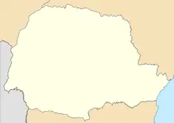
 LDB Location in Brazil  LDB LDB (Brazil) | |||||||||||
| Runways | |||||||||||
| |||||||||||
| Statistics (2021) | |||||||||||
| |||||||||||
Londrina–Gov. José Richa Airport (IATA: LDB, ICAO: SBLO) is the airport serving Londrina, Brazil. It is named after José Richa (1934–2003), former Mayor of Londrina and Governor of Paraná.
It is operated by CCR.
History
The airport was commissioned in 1936 but only in 1956 the runway was paved. In 1958 a new terminal, a project by Remo Veronesi, was opened, and in 2000 it was extensively renovated and enlarged.
Previously operated by Infraero, on April 7, 2021 CCR won a 30-year concession to operate the airport.[4]
Airlines and destinations
Accidents and incidents
- 13 December 1950: a VASP Douglas C-47A-90-DL registration PP-SPT while on initial climb from Londrina lost engine power, crashed and caught fire. There were 3 ground fatalities.[5]
- 14 September 1969: a VASP Douglas C-47B-45-DK registration PP-SPP operating flight 555 took off from Londrina to São Paulo-Congonhas but due to a feathered propeller, had to return to the origin. While on approach for landing, the aircraft made a sharp left turn and crashed. All 20 passengers and crew died.[6][7]
Statistics
Annual passenger traffic at LDB airport.
See Wikidata query.
Access
The airport is located 2 km (1 mi) southeast from downtown Londrina.
See also
References
- ↑ "Estatísticas". Infraero (in Portuguese). 14 February 2022. Retrieved 4 March 2022.
- ↑ "Aeroporto Gov. José Richa". Infraero (in Portuguese). Retrieved 30 May 2020.
- ↑ "Aeródromos". ANAC (in Portuguese). 29 June 2020. Retrieved 12 May 2021.
- ↑ "Governo federal arrecada R$ 3,3 bilhões com leilão de 22 aeroportos". Agência Brasil (in Portuguese). 7 April 2021. Retrieved 7 April 2021.
- ↑ "Accident description PP-SPT". Aviation Safety Network. Retrieved 28 July 2011.
- ↑ "Accident description PP-SPP". Aviation Safety Network. Retrieved 23 July 2011.
- ↑ Germano da Silva, Carlos Ari César (2008). "Arremetida monomotor". O rastro da bruxa: história da aviação comercial brasileira no século XX através dos seus acidentes 1928–1996 (in Portuguese) (2 ed.). Porto Alegre: EDIPUCRS. pp. 262–266. ISBN 978-85-7430-760-2.
External links
- Airport information for SBLO at Great Circle Mapper. Source: DAFIF (effective October 2006).
- Current weather for SBLO at NOAA/NWS
- Accident history for LDB at Aviation Safety Network
This article is issued from Wikipedia. The text is licensed under Creative Commons - Attribution - Sharealike. Additional terms may apply for the media files.