Montséret | |
|---|---|
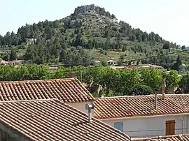 Roquelongue seen from Montséret | |
 Coat of arms | |
Location of Montséret | |
 Montséret 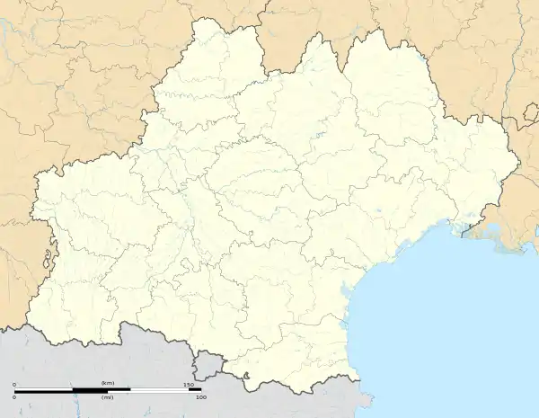 Montséret | |
| Coordinates: 43°06′13″N 2°48′42″E / 43.1036°N 2.8117°E | |
| Country | France |
| Region | Occitania |
| Department | Aude |
| Arrondissement | Narbonne |
| Canton | Les Corbières |
| Intercommunality | Région Lézignanaise, Corbières et Minervois |
| Government | |
| • Mayor (2022–2026) | Yves Fabre[1] |
| Area 1 | 11.31 km2 (4.37 sq mi) |
| Population | 628 |
| • Density | 56/km2 (140/sq mi) |
| Time zone | UTC+01:00 (CET) |
| • Summer (DST) | UTC+02:00 (CEST) |
| INSEE/Postal code | 11256 /11200 |
| Elevation | 55–240 m (180–787 ft) (avg. 97 m or 318 ft) |
| 1 French Land Register data, which excludes lakes, ponds, glaciers > 1 km2 (0.386 sq mi or 247 acres) and river estuaries. | |
Montséret is a commune in the Aude department in southern France. Montséret is a small wine-producing village in the wine district of Corbières. The village's annual festival is held in early- to mid-July and includes a community dinner.
Population
| Year | Pop. | ±% |
|---|---|---|
| 1962 | 351 | — |
| 1968 | 360 | +2.6% |
| 1975 | 308 | −14.4% |
| 1982 | 306 | −0.6% |
| 1990 | 347 | +13.4% |
| 1999 | 410 | +18.2% |
| 2008 | 483 | +17.8% |
See also
References
- ↑ "Répertoire national des élus: les maires" (in French). data.gouv.fr, Plateforme ouverte des données publiques françaises. 16 December 2022.
- ↑ "Populations légales 2021". The National Institute of Statistics and Economic Studies. 28 December 2023.
Wikimedia Commons has media related to Montséret.
This article is issued from Wikipedia. The text is licensed under Creative Commons - Attribution - Sharealike. Additional terms may apply for the media files.