Phibun Rak
พิบูลย์รักษ์ | |
|---|---|
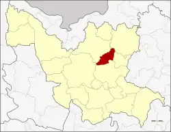 District location in Udon Thani province | |
| Coordinates: 17°32′57″N 103°3′27″E / 17.54917°N 103.05750°E | |
| Country | Thailand |
| Province | Udon Thani |
| Seat | Ban Daeng |
| Area | |
| • Total | 186.4 km2 (72.0 sq mi) |
| Population (2005) | |
| • Total | 24,185 |
| • Density | 129.7/km2 (336/sq mi) |
| Time zone | UTC+7 (ICT) |
| Postal code | 41130 |
| Geocode | 4123 |
Phibun Rak (Thai: พิบูลย์รักษ์, pronounced [pʰí.būːn rák]) is a district (amphoe) in central Udon Thani province, northeastern Thailand.
Geography
Neighboring districts are (from the north clockwise) Nong Han, Chai Wan, Si That, Kumphawapi, and Prachaksinlapakhom.
History
The minor district (king amphoe) was established on 1 April 1992 by splitting three tambons from Nong Han district.[1] It was upgraded to a full district on 11 October 1997.[2]
Administration
The district is divided into three sub-districts (tambons), which are further subdivided into 37 villages (mubans). There are no municipal (thesaban) areas, and three tambon administrative organizations (TAO).
| No. | Name | Thai name | Villages | Pop. | |
|---|---|---|---|---|---|
| 1. | Ban Daeng | บ้านแดง | 15 | 8,967 | |
| 2. | Na Sai | นาทราย | 11 | 8,077 | |
| 3. | Don Kloi | ดอนกลอย | 11 | 7,141 |
References
- ↑ ประกาศกระทรวงมหาดไทย เรื่อง แบ่งเขตท้องที่อำเภอหนองหาน จังหวัดอุดรธานี ตั้งเป็นกิ่งอำเภอพิบูลย์รักษ์ (PDF). Royal Gazette (in Thai). 109 (53 ง): 11. April 22, 1992. Archived from the original (PDF) on February 24, 2012.
- ↑ พระราชกฤษฎีกาตั้งอำเภอหนองปรือ อำเภอห้วยกระเจา อำเภอทรายทองวัฒนา อำเภอปางศิลาทอง อำเภอเนินสง่า อำเภอนาทม อำเภอพระพรหม อำเภอแม่วงก์ อำเภอสองแคว อำเภอบ้านใหม่ไชยพจน์ อำเภอไทยเจริญ อำเภอกาบัง อำเภอพยุห์ อำเภอเมืองจันทร์ อำเภอภูพาน อำเภอคลองหอยโข่ง อำเภอเขาฉกรรจ์ อำเภอนาวัง อำเภอพิบูลย์รักษ์ และอำเภอทุ่งศรีอุดม พ.ศ. ๒๕๔๐ (PDF). Royal Gazette (in Thai). 114 (50 ก): 24–27. September 26, 1997. Archived from the original (PDF) on January 27, 2012.
External links
This article is issued from Wikipedia. The text is licensed under Creative Commons - Attribution - Sharealike. Additional terms may apply for the media files.