Sang Khom
สร้างคอม | |
|---|---|
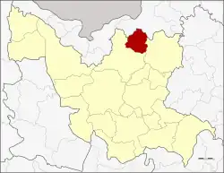 District location in Udon Thani province | |
| Coordinates: 17°49′32″N 103°5′19″E / 17.82556°N 103.08861°E | |
| Country | Thailand |
| Province | Udon Thani |
| Seat | Sang Khom |
| Area | |
| • Total | 287.179 km2 (110.880 sq mi) |
| Population (2005) | |
| • Total | 28,441 |
| • Density | 99.0/km2 (256/sq mi) |
| Time zone | UTC+7 (ICT) |
| Postal code | 41260 |
| Geocode | 4120 |
Sang Khom (Thai: สร้างคอม, pronounced [sâːŋ kʰɔ̄m]) is a district (amphoe) in northern Udon Thani province, northeastern Thailand.
Etymology
The district's original name was "Ban Sang Khom" (Thai: บ้านส่างคอม), only slightly different from the modern variation. The word sang (Thai: ส้าง) or (Thai: สร้าง) is (Thai: ส่าง) in the Lao-Isan dialect and means 'pond' or 'minor body of water', while khom (Thai: คอม) is a species of tree native to the area. A story is told that when the village was first established, around the year 1898, there was some digging going on in a local pond and after some time, khom trees grew around the pond's shore. Therefore, the villagers called the place "Sang Khom."[1]
Geography
Neighboring districts are (clockwise from the southeast) Ban Dung and Phen of Udon Thani Province and Phon Phisai of Nong Khai province.
Sang Khom district is home to Nam Pan Lake, a sizable body of freshwater in the northern part of the district.
History
The minor district (king amphoe) was established on 15 May 1975, when three tambons, Sang Khom, Ban Yuat, and Chiang Da, split from Phen district.[2] On 21 May 1990 it was upgraded to a full district.[3]
Administration
The district is divided into six sub-districts (tambons), which are further subdivided into 52 villages (mubans). There are no municipal (thesaban) areas, and six tambon administrative organizations (TAO).
| No. | Name | Thai name | Villages | Pop. | |
|---|---|---|---|---|---|
| 1. | Sang Khom | สร้างคอม | 13 | 7,512 | |
| 2. | Chiang Da | เชียงดา | 8 | 3,397 | |
| 3. | Ban Yuat | บ้านยวด | 6 | 4,090 | |
| 4. | Ban Khok | บ้านโคก | 10 | 7,263 | |
| 5. | Na Sa-at | นาสะอาด | 8 | 2,247 | |
| 6. | Ban Hin Ngom | บ้านหินโงม | 7 | 3,932 |
References
- ↑ url=http://www.amphoe.com/menu.php?am=785&pv=72&mid=1
- ↑ ประกาศกระทรวงมหาดไทย เรื่อง แบ่งท้องที่อำเภอเพ็ญ จังหวัดอุดรธานี ตั้งเป็นกิ่งอำเภอสร้างคอม (PDF). Royal Gazette (in Thai). 92 (94 ง): 1250. May 20, 1975. Archived from the original (PDF) on February 24, 2012.
- ↑ พระราชกฤษฎีกาตั้งอำเภอห้วยผึ้ง อำเภอวังวิเศษ อำเภอคลองหาด อำเภอป่าบอน อำเภอหนองหญ้าปล้อง อำเภอวังโป่ง อำเภอควนเนียง อำเภอหนองหญ้าไซ อำเภอบ้านนาเดิม อำเภอทุ่งฝน อำเภอสร้างคอม และอำเภอทองแสนขัน พ.ศ. ๒๕๓๓ (PDF). Royal Gazette (in Thai). 107 (83 ก special): 1–4. May 21, 1994. Archived from the original (PDF) on July 18, 2011.