Prachaksinlapakhom
ประจักษ์ศิลปาคม | |
|---|---|
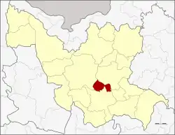 District location in Udon Thani province | |
| Coordinates: 17°16′22″N 102°59′39″E / 17.27278°N 102.99417°E | |
| Country | Thailand |
| Province | Udon Thani |
| Seat | Na Muang |
| Tambon | 3 |
| Muban | 41 |
| District established | 1997 |
| Area | |
| • Total | 144.8 km2 (55.9 sq mi) |
| Population (2015) | |
| • Total | 25,332 |
| • Density | 215.1/km2 (557/sq mi) |
| Time zone | UTC+7 (ICT) |
| Postal code | 41110 |
| Geocode | 4125 |
Prachaksinlapakhom (Thai: ประจักษ์ศิลปาคม) is a district (amphoe) in central Udon Thani province, northeastern Thailand.
Geography
Neighboring districts are (from the north clockwise) Nong Han, Ku Kaeo, Kumphawapi, and Mueang Udon Thani.
History
The minor district (king amphoe) was established on 1 June 1997 by splitting it from Kumphawapi district. The creation became effective on 1 July 1997.[1]
On 15 May 2007, all 81 minor districts were upgraded to full districts.[2] With publication in the Royal Gazette on 24 August, the upgrade became official.[3]
Administration
Central administration
Prachaksinlapakhom is divided into three sub-districts (tambons), which are further subdivided into 41 administrative villages (mubans).
| No. | Name | Thai | Villages | Pop.[4] |
|---|---|---|---|---|
| 1. | Na Muang | นาม่วง | 14 | 10,448 |
| 2. | Huai Sam Phat | ห้วยสามพาด | 13 | 7,000 |
| 3. | Um Chan | อุ่มจาน | 14 | 7,884 |
Local administration
There are three sub-district administrative organizations (SAO) in the district:
- Na Muang (Thai: องค์การบริหารส่วนตำบลนาม่วง) consisting of sub-district Na Muang.
- Huai Sam Phat (Thai: องค์การบริหารส่วนตำบลห้วยสามพาด) consisting of sub-district Huai Sam Phat.
- Um Chan (Thai: องค์การบริหารส่วนตำบลอุ่มจาน) consisting of sub-district Um Chan.
Economy
Huai Sam Phat and Na Muang Sub-districts are among five Udon Thani sub-districts to harbour mining operations of the Udon North potash mine, although the mine has met with local resistance.[5]
References
- ↑ ประกาศกระทรวงมหาดไทย เรื่อง แบ่งเขตท้องที่อำเภอกุมภวาปี จังหวัดอุดรธานี ตั้งเป็นกิ่งอำเภอประจักษ์ศิลปาคม (PDF). Royal Gazette (in Thai). 114 (Special 51 ง): 23. June 25, 1997. Archived from the original (PDF) on February 24, 2012.
- ↑ แถลงผลการประชุม ครม. ประจำวันที่ 15 พ.ค. 2550 (in Thai). Manager Online.
- ↑ พระราชกฤษฎีกาตั้งอำเภอฆ้องชัย...และอำเภอเหล่าเสือโก้ก พ.ศ. ๒๕๕๐ (PDF). Royal Gazette (in Thai). 124 (46 ก): 14–21. August 24, 2007. Archived from the original (PDF) on September 30, 2007.
- ↑ "Population statistics 2015" (in Thai). Department of Provincial Administration. Retrieved 2016-12-06.
- ↑ Saengpassa, Chularat (2015-07-13). "Locals up in arms over potash mine". The Nation. Retrieved 9 October 2017.