Saint-Michel | |
|---|---|
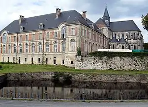 Saint-Michel Abbey | |
.svg.png.webp) Coat of arms | |
Location of Saint-Michel | |
 Saint-Michel  Saint-Michel | |
| Coordinates: 49°55′07″N 4°08′01″E / 49.9186°N 4.1336°E | |
| Country | France |
| Region | Hauts-de-France |
| Department | Aisne |
| Arrondissement | Vervins |
| Canton | Hirson |
| Intercommunality | CC Trois Rivières |
| Government | |
| • Mayor (2020–2026) | Thierry Verdavaine[1] |
| Area 1 | 42.2 km2 (16.3 sq mi) |
| Population | 3,252 |
| • Density | 77/km2 (200/sq mi) |
| Time zone | UTC+01:00 (CET) |
| • Summer (DST) | UTC+02:00 (CEST) |
| INSEE/Postal code | 02684 /02830 |
| Elevation | 172–278 m (564–912 ft) (avg. 201 m or 659 ft) |
| 1 French Land Register data, which excludes lakes, ponds, glaciers > 1 km2 (0.386 sq mi or 247 acres) and river estuaries. | |
Saint-Michel (French pronunciation: [sɛ̃ miʃɛl] ⓘ) is a commune in the Aisne department in Hauts-de-France in northern France. It is also unofficially called Saint-Michel-en-Thiérache.
Population
| Year | Pop. | ±% p.a. |
|---|---|---|
| 1968 | 4,342 | — |
| 1975 | 4,155 | −0.63% |
| 1982 | 4,044 | −0.39% |
| 1990 | 3,783 | −0.83% |
| 1999 | 3,656 | −0.38% |
| 2007 | 3,521 | −0.47% |
| 2012 | 3,542 | +0.12% |
| 2017 | 3,417 | −0.72% |
| Source: INSEE[3] | ||
Personalities
- French Revolution leader Antoine Joseph Santerre, whose family moved from Saint-Michel to Paris before the Revolution.
See also
References
- ↑ "Répertoire national des élus: les maires". data.gouv.fr, Plateforme ouverte des données publiques françaises (in French). 2 December 2020.
- ↑ "Populations légales 2021". The National Institute of Statistics and Economic Studies. 28 December 2023.
- ↑ Population en historique depuis 1968, INSEE
Wikimedia Commons has media related to Saint-Michel, Aisne.
This article is issued from Wikipedia. The text is licensed under Creative Commons - Attribution - Sharealike. Additional terms may apply for the media files.