Seringes-et-Nesles | |
|---|---|
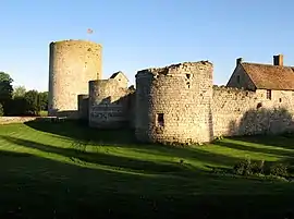 The chateau of Nesles | |
Location of Seringes-et-Nesles | |
 Seringes-et-Nesles  Seringes-et-Nesles | |
| Coordinates: 49°12′22″N 3°32′30″E / 49.2061°N 3.5417°E | |
| Country | France |
| Region | Hauts-de-France |
| Department | Aisne |
| Arrondissement | Château-Thierry |
| Canton | Fère-en-Tardenois |
| Intercommunality | CA Région de Château-Thierry |
| Government | |
| • Mayor (2020–2026) | Didier Fernandez[1] |
| Area 1 | 13.49 km2 (5.21 sq mi) |
| Population | 264 |
| • Density | 20/km2 (51/sq mi) |
| Time zone | UTC+01:00 (CET) |
| • Summer (DST) | UTC+02:00 (CEST) |
| INSEE/Postal code | 02713 /02130 |
| Elevation | 117–193 m (384–633 ft) (avg. 165 m or 541 ft) |
| 1 French Land Register data, which excludes lakes, ponds, glaciers > 1 km2 (0.386 sq mi or 247 acres) and river estuaries. | |
Seringes-et-Nesles (French pronunciation: [səʁɛ̃ʒ e nɛl]) is a commune in the Aisne department in Hauts-de-France in northern France.
History
The villages of Seringes and Nesles merged between 1790 and 1794.
Population
| Year | Pop. | ±% |
|---|---|---|
| 1962 | 283 | — |
| 1968 | 278 | −1.8% |
| 1975 | 217 | −21.9% |
| 1982 | 218 | +0.5% |
| 1990 | 245 | +12.4% |
| 1999 | 237 | −3.3% |
| 2008 | 290 | +22.4% |
| 2012 | 289 | −0.3% |
See also
References
- ↑ "Répertoire national des élus: les maires" (in French). data.gouv.fr, Plateforme ouverte des données publiques françaises. 13 September 2022.
- ↑ "Populations légales 2021". The National Institute of Statistics and Economic Studies. 28 December 2023.
Wikimedia Commons has media related to Seringes-et-Nesles.
This article is issued from Wikipedia. The text is licensed under Creative Commons - Attribution - Sharealike. Additional terms may apply for the media files.