Santenay | |
|---|---|
Commune | |
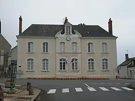 Town hall | |
Location of Santenay | |
 Santenay 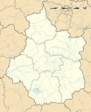 Santenay | |
| Coordinates: 47°34′03″N 1°07′02″E / 47.5675°N 1.1172°E | |
| Country | France |
| Region | Centre-Val de Loire |
| Department | Loir-et-Cher |
| Arrondissement | Blois |
| Canton | Veuzain-sur-Loire |
| Intercommunality | CA Blois Agglopolys |
| Government | |
| • Mayor (2020–2026) | Alain Prot[1] |
| Area 1 | 30.28 km2 (11.69 sq mi) |
| Population | 289 |
| • Density | 9.5/km2 (25/sq mi) |
| Time zone | UTC+01:00 (CET) |
| • Summer (DST) | UTC+02:00 (CEST) |
| INSEE/Postal code | 41234 /41190 |
| Elevation | 94–144 m (308–472 ft) (avg. 115 m or 377 ft) |
| 1 French Land Register data, which excludes lakes, ponds, glaciers > 1 km2 (0.386 sq mi or 247 acres) and river estuaries. | |
Santenay (French pronunciation: [sɑ̃tnɛ]) is a commune in the Loir-et-Cher department in central France, located between Château-Renault and Blois.
Population
| Year | Pop. | ±% p.a. |
|---|---|---|
| 1968 | 360 | — |
| 1975 | 307 | −2.25% |
| 1982 | 262 | −2.24% |
| 1990 | 229 | −1.67% |
| 1999 | 254 | +1.16% |
| 2007 | 265 | +0.53% |
| 2012 | 286 | +1.54% |
| 2017 | 290 | +0.28% |
| Source: INSEE[3] | ||
See also
References
- ↑ "Répertoire national des élus: les maires" (in French). data.gouv.fr, Plateforme ouverte des données publiques françaises. 13 September 2022.
- ↑ "Populations légales 2021". The National Institute of Statistics and Economic Studies. 28 December 2023.
- ↑ Population en historique depuis 1968, INSEE
Wikimedia Commons has media related to Santenay (Loir-et-Cher).
This article is issued from Wikipedia. The text is licensed under Creative Commons - Attribution - Sharealike. Additional terms may apply for the media files.