Wonosobo Regency
ꦑꦧꦸꦥꦠꦺꦤ꧀ꦮꦤꦱꦧ | |
|---|---|
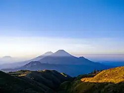 View of Mount Sindoro and Mount Sumbing from the peak of Mount Prau in Wonosobo | |
 Coat of arms | |
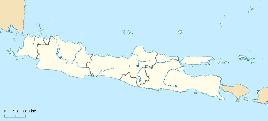
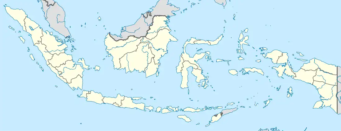
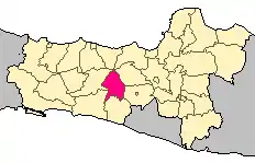 Location within Central Java | |
| Coordinates: 7°16′15″S 109°54′51″E / 7.2708631°S 109.9140472°E | |
| Country | Indonesia |
| Region | Java |
| Province | Central Java |
| Capital | Wonosobo |
| Government | |
| • Regent | Eko Purnomo |
| • Vice Regent | Agus Subagyo |
| Area | |
| • Total | 984.68 km2 (380.19 sq mi) |
| Population (mid 2022 estimate) | |
| • Total | 923,793 |
| • Density | 940/km2 (2,400/sq mi) |
| [1] | |
| Time zone | UTC+7 (IWST) |
| Area code | (+62) 286 |
| Website | wonosobokab |


Wonosobo Regency (Javanese: ꦑꦧꦸꦥꦠꦺꦤ꧀ꦮꦤꦱꦧ, romanized: Kabupatèn Wanasaba) is a regency (Indonesian: kabupaten) in Central Java province in Indonesia. Its capital is the town of Wonosobo, located at 7°22′07″S 109°53′54″E / 7.3684940°S 109.8983841°E, about 120 km from Semarang. The regency is located in the town of Wonosobo on the Dieng Plateau. Its area is 984.68 km2 and its population was 754,883 at the 2010 census[2] and 879,124 at the 2020 census;[3] the official estimate as at mid 2022 was 923,793.[1]
Etymology
The word "Wonosobo" is derived from Javanese Wanasaba, which in turn came from Sanskrit Vanasabhā. It literally means 'the gathering place in the forest'.
Administrative districts
Wonosobo Regency is divided into the following fifteen districts (kecamatan), tabulated below with their areas and their populations at the 2010 census[2] and the 2020 census,[3] together with the official estimates as at mid 2022.[1] The table also includes the location of the district headquarters, the number of administrative villages in each district (totalling 236 rural desa and 29 urban kelurahan), and its post code.
| Kode Wilayah | Name of District (kecamatan) | Area in km2 | Pop'n census 2010 | Pop'n census 2020 | Pop'n estimate mid 2022 | Admin centre | No. of villages | Post code |
|---|---|---|---|---|---|---|---|---|
| 33.07.01 | Wadaslintang | 127.16 | 51,402 | 60,502 | 64,778 | Wadaslintang | 17 (a) | 56365 |
| 33.07.02 | Kepil | 93.87 | 56,184 | 64,478 | 68,028 | Kepil | 21 (a) | 56374 |
| 33.07.03 | Sapuran | 77.72 | 53,845 | 61,209 | 64,662 | Sapuram | 17 (a) | 56375 |
| 33.07.15 | Kalibawang | 47.82 | 22,269 | 27,101 | 29,082 | Karangsambung | 8 | 56373 |
| 33.07.04 | Kaliwiro | 100.08 | 43,978 | 51,824 | 55,696 | Kaliwiro | 21 (a) | 56364 |
| 33.07.05 | Leksono | 44.07 | 39,159 | 46,186 | 48,414 | Leksono | 14 (a) | 56362 |
| 33.07.14 | Sukoharjo | 54.29 | 31,228 | 35,459 | 36,837 | Sukoharjo | 17 | 56363 |
| 33.07.06 | Selomerto | 39.71 | 44,849 | 53,516 | 56,064 | Selomerto | 24 (b) | 56361 |
| 33.07.07 | Kalikajar | 83.30 | 57,476 | 70,302 | 74,934 | Kalikajar | 19 (a) | 56372 |
| 33.07.08 | Kertek | 62.14 | 76,386 | 90,207 | 94,550 | Kertek | 21 (c) | 56371 |
| 33.07.09 | Wonosobo (town) | 32.38 | 82,488 | 91,909 | 95,476 | Jaraksari | 20 (d) | 56311 - 56319 |
| 33.07.10 | Watumalang | 68.23 | 48,569 | 55,765 | 58,990 | Wonoroto | 16 (a) | 56352 |
| 33.07.11 | Mojotengah | 45.07 | 58,163 | 67,481 | 68,916 | Kalibeber | 19 (e) | 56351 |
| 33.07.12 | Garung | 51.22 | 47,954 | 56,988 | 59,482 | Garung | 15 (a) | 56353 |
| 33.07.13 | Kejajar | 57.62 | 40,933 | 46,197 | 47,884 | Kejajar | 16 (a) | 56354 |
| Totals | 984.68 | 754,883 | 879,124 | 923,793 | Wonosobo | 265 |
Notes: (a) including one kelurahan (the district administrative centre). (b) including 2 kelurahan (Selomerto and Wonorejo). (c) includes 2 kelurahan (Kertek and Wringinanom).
(d) comprises 13 kelurahan (Bumireso, Jaraksari, Jlamprang, Kalianget, Kejiwan, Kramatan, Mlipak, Pagerkukuh, Rojoimo, Sambek, Tawangsari, Wonosobo Barat and Wonosobo Timur) and 7 desa.
(e) comprises 3 kelurahan (Andongsili, Kalibeber and Mudal) and 16 desa.
The 29 kelurahan (urban villages) are thus split over 13 districts, with 13 in Wonosobo (town) District, 3 in Mojotengah District, 2 in Selomerto District, 2 in Kertek District, and 1 each in Wadaslintang, Kepil, Sapuran, Kaliwiro, Leksono, Kalikajar, Watumalang, Garung and Kejajar Districts (in the latter cases the sole kelurahan is the district administrative headquarters).
Climate
Wonosobo has an elevation moderated tropical rainforest climate (Af) with moderate rainfall from July to September and heavy to very heavy rainfall in the remaining months. The following climate data is for the town of Wonosobo.
| Climate data for Wonosobo | |||||||||||||
|---|---|---|---|---|---|---|---|---|---|---|---|---|---|
| Month | Jan | Feb | Mar | Apr | May | Jun | Jul | Aug | Sep | Oct | Nov | Dec | Year |
| Mean daily maximum °C (°F) | 26.0 (78.8) |
26.2 (79.2) |
26.6 (79.9) |
26.8 (80.2) |
27.1 (80.8) |
27.1 (80.8) |
26.9 (80.4) |
27.3 (81.1) |
27.5 (81.5) |
27.7 (81.9) |
26.8 (80.2) |
26.0 (78.8) |
26.8 (80.3) |
| Daily mean °C (°F) | 22.0 (71.6) |
22.1 (71.8) |
22.4 (72.3) |
22.5 (72.5) |
22.8 (73.0) |
22.3 (72.1) |
21.8 (71.2) |
22.0 (71.6) |
22.4 (72.3) |
22.9 (73.2) |
22.4 (72.3) |
21.8 (71.2) |
22.3 (72.1) |
| Mean daily minimum °C (°F) | 18.0 (64.4) |
18.0 (64.4) |
18.2 (64.8) |
18.3 (64.9) |
18.5 (65.3) |
17.5 (63.5) |
16.7 (62.1) |
16.7 (62.1) |
17.3 (63.1) |
18.1 (64.6) |
18.1 (64.6) |
17.7 (63.9) |
17.8 (64.0) |
| Average rainfall mm (inches) | 513 (20.2) |
443 (17.4) |
486 (19.1) |
339 (13.3) |
254 (10.0) |
136 (5.4) |
110 (4.3) |
93 (3.7) |
118 (4.6) |
237 (9.3) |
357 (14.1) |
486 (19.1) |
3,572 (140.5) |
| Source: Climate-Data.org[4] | |||||||||||||
References
External links
Regencies and cities of Central Java | ||
|---|---|---|
Capital: Semarang | ||
| Regencies |  | |
| Cities | ||