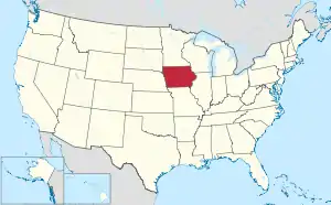
Map of the United States with Iowa highlighted
This is a list of census-designated places in Iowa. The United States Census Bureau defines census-designated places as unincorporated communities lacking elected municipal officers and boundaries with legal status.[1]
As of the 2020 census, Iowa has 86 census-designated places,[2] up from 62 in the 2010 census.[3] Most CDPs in the state are small rural communities.
Census-designated places
See also
References
- ↑ "Geographic Terms and Concepts– Place". United States Census Bureau. United States Department of Commerce.
- 1 2 3 "Places: Iowa". 2020 United States Census. United States Census Bureau. Retrieved January 18, 2022.
- ↑ "2010 Census Gazetteer Files". 2010 United States Census. United States Census Bureau. Retrieved January 18, 2022.
- ↑ "Explore Census Data". United States Census Bureau. Retrieved January 18, 2022.
This article is issued from Wikipedia. The text is licensed under Creative Commons - Attribution - Sharealike. Additional terms may apply for the media files.