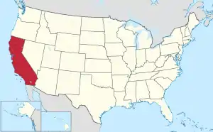
Map of the United States with California highlighted in red
Location of California in the United States

California is the most populous and third largest U.S. state by area, located on the West Coast of the United States. According to the 2010 United States Census, California's population is 37,253,956 and has 155,779.22 square miles (403,466.3 km2) of land.[1]

California is divided into 58 counties and contains 1,043 census designated-places (CDPs)[2] (1,034 as of 2017). San Francisco is a consolidated city–county, which means that San Francisco County does not contain any CDPs.

The census-designated places in this list have a population of 10,000 or higher. Eastvale, Glen Avon, Mira Loma, Pedley, and Rubidoux have incorporated since the 2010 Census and thus are omitted from this list.

Census-Designated Places
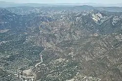
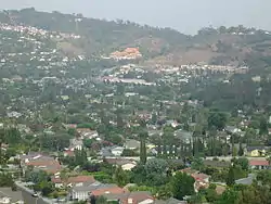
Eaton Canyon with an aerial view of Altadena
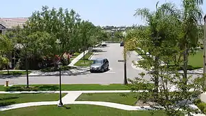
Fair Oaks Blvd in Fair Oaks
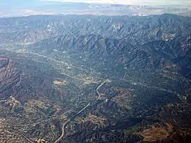
Aerial view of La Crescenta-Montrose
Downtown Alamo
Irish Hills with a view of Los Osos
Name County Population (2020)[2] Land area[2]
sq mi km2
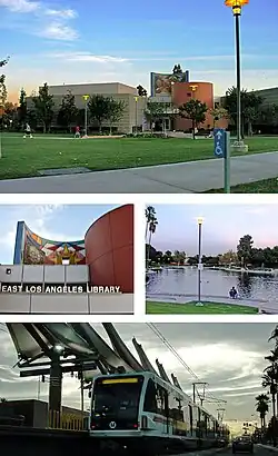
East Los Angeles Los Angeles 118,786 7.45 19.3
Arden-Arcade Sacramento 94,659 17.83 46.2
Florence-Graham Los Angeles 61,983 3.58 9.3
Carmichael Sacramento 79,793 13.53 35.0
Castro Valley Alameda 66,441 16.64 43.1
South Whittier Los Angeles 56,415 5.34 13.8
Hacienda Heights Los Angeles 54,191 11.18 29.0
Rowland Heights Los Angeles 48,321 13.08 33.9
Florin Sacramento 52,388 8.70 22.5
Antelope Sacramento 45,770 6.84 17.7
Altadena Los Angeles 42,846 8.71 22.6
North Highlands Sacramento 49,327 8.83 22.9
El Dorado Hills El Dorado 50,147 48.45 125.5
Willowbrook Los Angeles 24,395 3.76 9.7
Orcutt Santa Barbara 32,034 11.12 28.8
La Presa San Diego 35,033 5.50 14.2
Orangevale Sacramento 35,569 11.52 29.8
Foothill Farms Sacramento 35,834 4.20 10.9
Oildale Kern 36,135 6.53 16.9
Westmont Los Angeles 33,913 1.85 4.8
Fair Oaks Sacramento 32,514 10.79 27.9
Fallbrook San Diego 32,267 17.53 45.4
Spring Valley San Diego 30,998 7.17 18.6
West Whittier-Los Nietos Los Angeles 25,325 2.52 6.5
North Tustin Orange 25,718 6.67 17.3
Vineyard Sacramento 43,935 17.21 44.6
Bloomington San Bernardino 24,339 5.99 15.5
San Lorenzo Alameda 29,581 2.76 7.1
Isla Vista Santa Barbara 15,500 1.85 4.8
French Valley Riverside 35,280 10.87 28.2
Ladera Ranch Orange 26,170 4.91 12.7
Valinda Los Angeles 22,437 2.01 5.2
Lennox Los Angeles 20,323 1.09 2.8
Rosemont Sacramento 23,510 4.35 11.3
West Puente Valley Los Angeles 22,959 1.76 4.6
Temescal Valley Riverside 26,232 19.30 50.0
Ashland Alameda 23,823 1.84 4.8
West Carson Los Angeles 22,870 2.27 5.9
Bay Point Contra Costa 23,896 6.55 17.0
Rancho San Diego San Diego 21,858 8.70 22.5
Lakeside San Diego 21,152 6.90 17.9
Winter Gardens San Diego 22,380 4.43 11.5
South San Jose Hills Los Angeles 19,855 1.51 3.9
Granite Bay Placer 21,247 21.53 55.8
Ramona San Diego 21,468 38.41 99.5
La Crescenta Montrose Los Angeles 19,997 3.43 8.9
Castaic Los Angeles 18,937 7.26 18.8
Casa de Oro-Mount Helix San Diego 19,576 6.85 17.7
Mead Valley Riverside 19,819 19.17 49.7
Cameron Park El Dorado 18,881 28.77 74.5
Rosamond Kern 20,961 52.12 135.0
Linda Yuba 21,654 8.55 22.1
Prunedale Monterey 18,885 46.05 119.3
Stevenson Ranch Los Angeles 20,178 6.36 16.5
East Hemet Riverside 19,432 5.21 13.5
Live Oak Santa Cruz 17,038 3.24 8.4
Nipomo San Luis Obispo 18,176 14.85 38.5
Walnut Park Los Angeles 15,214 0.75 1.9
Vincent Los Angeles 15,714 1.47 3.8
Avocado Heights Los Angeles 13,317 2.70 7.0
Alum Rock Santa Clara 12,042 1.20 3.1
Bostonia San Diego 16,882 1.93 5.0
McKinleyville Humboldt 16,262 20.80 53.9
East Rancho Dominguez Los Angeles 15,114 0.82 2.1
Lamont Kern 14,049 4.59 11.9
Rio Linda Sacramento 15,944 9.90 25.6
East San Gabriel Los Angeles 22,769 1.56 4.0
Coto de Caza Orange 14,710 7.95 20.6
Alamo Contra Costa 15,314 9.67 25.0
Cherryland Alameda 15,808 1.20 3.1
North Fair Oaks San Mateo 14,027 1.20 3.1
Parkway Sacramento 15,962 2.42 6.3
Valle Vista Riverside 16,194 6.87 17.8
Woodcrest Riverside 15,378 11.41 29.6
Phelan San Bernardino 13,859 60.10 155.7
Los Osos San Luis Obispo 14,465 12.76 33.0
Alpine San Diego 14,696 26.78 69.4
Rosedale Kern 18,639 33.96 88.0
Oak Park Ventura 13,898 5.29 13.7
Stanford Santa Clara 21,150 2.73 7.1
Lemon Hill Sacramento 14,496 1.63 4.2
Salida Stanislaus 13,886 5.32 13.8
Olivehurst Yuba 16,595 7.47 19.3
Discovery Bay Contra Costa 15,358 6.22 16.1
North Auburn Placer 13,452 7.80 20.2
El Sobrante Riverside 14,039 18.68 48.4
El Sobrante Contra Costa 15,524 2.77 7.2
Bonita San Diego 12,917 5.00 12.9
Lake Arrowhead San Bernardino 12,401 17.73 45.9
Lake Los Angeles Los Angeles 13,187 9.74 25.2
Big Bear City San Bernardino 12,738 31.95 82.8
Home Gardens Riverside 11,203 1.56 4.0
Sun Village Los Angeles 12,345 10.69 27.7
Lakeland Village Riverside 12,364 8.68 22.5
Magalia Butte 7,795 14.02 36.3
View Park-Windsor Hills Los Angeles 11,419 1.84 4.8
Diamond Springs El Dorado 11,345 16.64 43.1
Quartz Hill Los Angeles 11,447 3.76 9.7
Citrus Los Angeles 10,243 0.89 2.3
La Riviera Sacramento 11,252 1.85 4.8
Crestline San Bernardino 11,650 13.84 35.8
Delhi Merced 10,656 3.51 9.1
Tamalpais-Homestead Valley Marin 11,492 4.64 12.0
Garden Acres San Joaquin 11,398 2.59 6.7
Muscoy San Bernardino 10,719 3.14 8.1
Camp Pendleton South San Diego 12,468 3.91 10.1
Winton Merced 11,709 3.04 7.9
Rossmoor Orange 10,625 1.54 4.0
San Diego Country Estates San Diego 10,395 16.85 43.6
Fairview Alameda 11,341 2.77 7.2
Del Aire Los Angeles 10,338 1.01 2.6

See also

References

  1. "GCT-PH1 Population, Housing Units, Area, and Density: 2010 State Place and (in selected states) County Subdivision". 2010 United States Census. United States Census Bureau. Archived from the original on February 12, 2020. Retrieved January 16, 2012.
  2. 1 2 3 "QuickFacts United States". April 1, 2020.
This article is issued from Wikipedia. The text is licensed under Creative Commons - Attribution - Sharealike. Additional terms may apply for the media files.