Murato | |
|---|---|
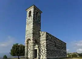 San Michele church | |
.svg.png.webp) Coat of arms | |
Location of Murato | |
 Murato 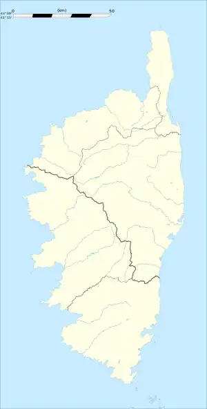 Murato | |
| Coordinates: 42°34′41″N 9°19′36″E / 42.5781°N 9.3267°E | |
| Country | France |
| Region | Corsica |
| Department | Haute-Corse |
| Arrondissement | Calvi |
| Canton | Biguglia-Nebbio |
| Government | |
| • Mayor (2020–2026) | Claude Flori[1] |
| Area 1 | 20.38 km2 (7.87 sq mi) |
| Population | 567 |
| • Density | 28/km2 (72/sq mi) |
| Time zone | UTC+01:00 (CET) |
| • Summer (DST) | UTC+02:00 (CEST) |
| INSEE/Postal code | 2B172 /20239 |
| Elevation | 239–1,112 m (784–3,648 ft) (avg. 497 m or 1,631 ft) |
| 1 French Land Register data, which excludes lakes, ponds, glaciers > 1 km2 (0.386 sq mi or 247 acres) and river estuaries. | |
Murato (French pronunciation: [muʁato], Italian pronunciation: [muˈraːto]; Corsican: Muratu, pronounced [muˈradu]) is a commune in the Upper Corsica department of France on the island of Corsica.
Population
| Year | Pop. | ±% p.a. |
|---|---|---|
| 1968 | 538 | — |
| 1975 | 538 | +0.00% |
| 1982 | 533 | −0.13% |
| 1990 | 565 | +0.73% |
| 1999 | 555 | −0.20% |
| 2009 | 607 | +0.90% |
| 2014 | 609 | +0.07% |
| 2020 | 565 | −1.24% |
| Source: INSEE[3] | ||
Monuments
See also
References
- ↑ "Répertoire national des élus: les maires". data.gouv.fr, Plateforme ouverte des données publiques françaises (in French). 2 December 2020.
- ↑ "Populations légales 2021". The National Institute of Statistics and Economic Studies. 28 December 2023.
- ↑ Population en historique depuis 1968, INSEE
Wikimedia Commons has media related to Murato.
This article is issued from Wikipedia. The text is licensed under Creative Commons - Attribution - Sharealike. Additional terms may apply for the media files.