Prato-di-Giovellina | |
|---|---|
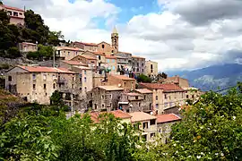 A view of the village of Prato-di-Giovellina | |
Location of Prato-di-Giovellina | |
 Prato-di-Giovellina 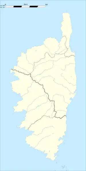 Prato-di-Giovellina | |
| Coordinates: 42°25′28″N 9°09′51″E / 42.4244°N 9.1642°E | |
| Country | France |
| Region | Corsica |
| Department | Haute-Corse |
| Arrondissement | Corte |
| Canton | Golo-Morosaglia |
| Government | |
| • Mayor (2020–2026) | Pierre Nasica[1] |
| Area 1 | 12.21 km2 (4.71 sq mi) |
| Population | 48 |
| • Density | 3.9/km2 (10/sq mi) |
| Time zone | UTC+01:00 (CET) |
| • Summer (DST) | UTC+02:00 (CEST) |
| INSEE/Postal code | 2B248 /20218 |
| Elevation | 235–848 m (771–2,782 ft) (avg. 650 m or 2,130 ft) |
| 1 French Land Register data, which excludes lakes, ponds, glaciers > 1 km2 (0.386 sq mi or 247 acres) and river estuaries. | |
Prato-di-Giovellina is a commune in the Haute-Corse department of France on the island of Corsica.
Population
| Year | Pop. | ±% |
|---|---|---|
| 1962 | 41 | — |
| 1968 | 57 | +39.0% |
| 1975 | 54 | −5.3% |
| 1982 | 47 | −13.0% |
| 1990 | 39 | −17.0% |
| 1999 | 40 | +2.6% |
| 2008 | 53 | +32.5% |
See also
References
- ↑ "Répertoire national des élus: les maires". data.gouv.fr, Plateforme ouverte des données publiques françaises (in French). 2 December 2020.
- ↑ "Populations légales 2021". The National Institute of Statistics and Economic Studies. 28 December 2023.
Wikimedia Commons has media related to Prato-di-Giovellina.
This article is issued from Wikipedia. The text is licensed under Creative Commons - Attribution - Sharealike. Additional terms may apply for the media files.