Tox
Tocchisu | |
|---|---|
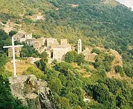 Tox, seen from the road to Moïta | |
Location of Tox | |
 Tox 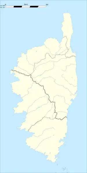 Tox | |
| Coordinates: 42°15′07″N 9°25′51″E / 42.2519°N 9.4308°E | |
| Country | France |
| Region | Corsica |
| Department | Haute-Corse |
| Arrondissement | Corte |
| Canton | Ghisonaccia |
| Government | |
| • Mayor (2020–2026) | Pascal Chessa[1] |
| Area 1 | 14.79 km2 (5.71 sq mi) |
| Population | 97 |
| • Density | 6.6/km2 (17/sq mi) |
| Time zone | UTC+01:00 (CET) |
| • Summer (DST) | UTC+02:00 (CEST) |
| INSEE/Postal code | 2B328 /20270 |
| Elevation | 50–1,093 m (164–3,586 ft) (avg. 440 m or 1,440 ft) |
| 1 French Land Register data, which excludes lakes, ponds, glaciers > 1 km2 (0.386 sq mi or 247 acres) and river estuaries. | |
Tox is a commune in the Haute-Corse department of France on the island of Corsica.
Population
| Year | Pop. | ±% p.a. |
|---|---|---|
| 1968 | 146 | — |
| 1975 | 148 | +0.19% |
| 1982 | 180 | +2.84% |
| 1990 | 169 | −0.79% |
| 1999 | 142 | −1.92% |
| 2009 | 100 | −3.45% |
| 2014 | 99 | −0.20% |
| 2020 | 97 | −0.34% |
| Source: INSEE[3] | ||
See also
References
- ↑ "Répertoire national des élus: les maires". data.gouv.fr, Plateforme ouverte des données publiques françaises (in French). 2 December 2020.
- ↑ "Populations légales 2020". The National Institute of Statistics and Economic Studies. 29 December 2022.
- ↑ Population en historique depuis 1968, INSEE
Wikimedia Commons has media related to Tox (Haute-Corse).
This article is issued from Wikipedia. The text is licensed under Creative Commons - Attribution - Sharealike. Additional terms may apply for the media files.